I was calm, why? This was a disaster. Fuck, where is my shoe? Either someone took it overnight, or an animal did so. I had left if outside my tent in the vestibule overnight, but now, as I was all packed, just putting on my shoes to discover one missing.
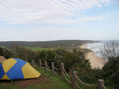
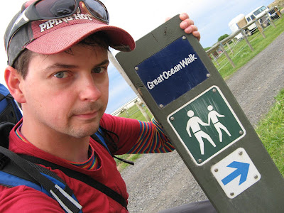
Day 2: Blanket Bay to Aire River
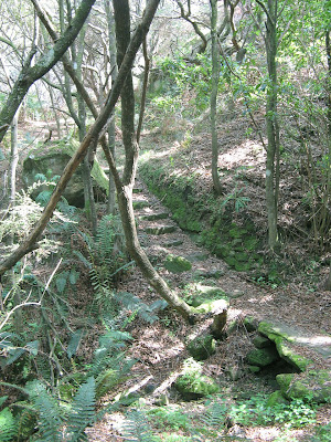
Rated 'easy', the route to Parker River Inlet is through dry coastal forests. Rated 'medium', the hike to Cape Otway is along clifftops, with Manna Gums inhabitated by koalas, then alongside a mown track to the lighthouse. Rated 'medium', the hike to Aire River follows wind sculpted slopes and clifftops, traversing a sandy track.

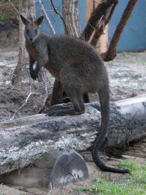
Madly, I looked around my tent - no shoe to be seen. It can't have been the other couple here - who does that anyway - if it was them surely they would leave it hanging from a tree. I had my ugg boats, so could go for help, but my 6-day hike would be over. Having just got up, I found a suitable spot to relieve myself. There was little I could do. Then as was doing my business, just beyond under a tree, was my upturned shoe, the red sole attracting my gaze. It was quite wet, but not inside because it was upturned. I don't care why an animal dragged it ten metres from my tent, or what they did with it, I was so relieved to find it, and as a bonus dry and intact. My chief suspect if the kangaroo - no, wallaby - no, numbat?? that I made friends with last night. It was not fussed by my presence, acting all cute and friendly. As I cooked dinner, it came closer and closer to forage. Lucky for me I had decided early on not to leave my pack in the tent vestibule, it needed to be inside to protect it from animals, I had learnt this elsewhere before, and my two man tent is large enough for my pack too. But leaving my shoes inside too? I hadn't thought of that!
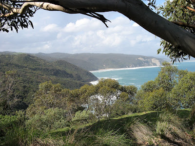
A long hike today, again two suggested hiking legs in one day. Blanket Bay to Parker Inlet was cool, all foresty, and the view over Parket Inlet was fantastic, although no photos did it justice.
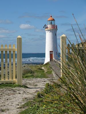
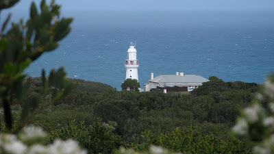
The scenery towards Cape Otway Lighthouse changed increasingly from forest to coastal salt bush. It was a tough getting to the lighthouse, but perhaps mainly because I saw it much sooner than I expected, then spent forever actually reaching it.
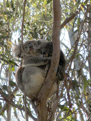
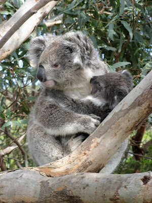
Came face-to-face with a koala. I was trying to duck down under a low hanging branch - this can be quite difficult with a 21kg pack - when I looked up to see a koala just inches from my face! After a few photos, I thought it best to head bush to go around the koala.
The lighthouse wasn't the landmark or photo opportunity I had hoped it would be. You couldn't see any of it from the carpark, the closest you could get without paying an entrance fee. You could see it by doing a self-guided tour, and I don't think the $13 entrance fee was too much, it just seemed too much like car-sightseeing, it was odd to be around all these old fat people who complained having to walk from their car. In the shop, I purchased an ice cream, and a couple came in. They asked how far it was to walk to the lighthouse, 440 metres they were told. Oh, that's too far, they replied. I had seen them park their car in the carpark, they didn't select the disabled carpark, and seemed fine to walk. I guess some people are just lazy. I took that as a sign to move on, maybe I would return on Friday arvo when I finished the trail.
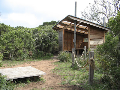
I had lunch at the Cape Otway hike-in campsite, the end of the suggested hike leg. The shelters in the hike-in campsites are fantastic, they are well set up. Only Blanket Bay didn't have a shelter, it was still being built. As I was busy preparing lunch, two rangers stumbled in, in search of forty cows that had escaped a nearby farm. There was pleny of evidence of the cows, but they were no-where to be seen.
As I hiked on, I came across the lighthouse cemetary in the sand dunes. The sand dunes had been busy reclaiming their territory, but it was a cool spot.
From here to Aire River wasn't heaps interesting - lots of walking in sand dunes. I was too late to choose the beach route due to high tide. Aire River was a good sight for my sore feet and pained shoulders. All good though - no blisters. Bruises on my shoulders and hips, yes, and very sore feet, but all good.
I had been prepared for a wet day because it had rained all last day, but it was a warm sunny afternoon, yay.
View photos in
full-screen mode
| I Say |
They Say |
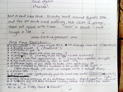
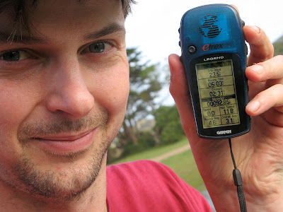
Distance
Total time
Odometer
Moving time
Stopped time
Start time
End time
Moving average
Overall average
Max speed
|
22.1km
8h 06m
41.0km
4h 33m
3h 33m
8.30am
4.00pm
4.9km/h
2.7km/h
22.2km/h ??
|
Distance
Total time
|
20km
7h 30m
|
Select alternative blog entry to view:
Day 1: Apollo Bay to Blanket Bay
Day 2: Blanket Bay to Aire River
Day 3: Aire River to Johanna Beach
Day 4: Johanna Beach to Ryans Den
Day 5: Ryans Den to Princetown