Having just returned from four months travelling around Western Australia and the Northern Territory - hiking over 600km of trail through gorges with waterfalls - I was a little surprised by how much water we saw in Mt Remarkable National Park, and, by how much I enjoyed this hike near home.
Mt Remarkable National Park
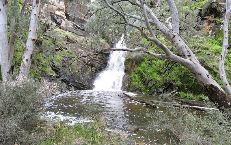
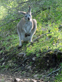 I have hiked here three or four times over the past five years. I was impressed. Green was everywhere, the creeks flowing, even large waterfalls. Lots of roos munching on green grass. A winter wonderland.
A great weekend hiking a track I had wanted to do for a number of years. We hiked from Mambray Creek campground along Mambray Creek Track, over Black Range - climbing up 500 metres - through to the Racecourse Track in the shadow of Mt Remarkable summit. We walked along Spring Creek, strongly flowing, we crossed the creek more than a dozen times. In all, we did water crossings over twenty times, far more than I had done in the entire 1,200 kilometre Heysen Trail.
We spent the night at the very nice Grays Hut, in the Racecourse clearing. A modern hut built around the ruins of an old dairy farmer's hut.
Download kml file to view in Google Earth or adapt to use as a navigational aid in a GPS unit |
| Stats | Black Range Trek, Mt Remarkable National Park | |
| Saturday | Sunday | |
| 28/08/2010 | 29/08/2010 | |
| Mambray Creek campground to Grays Hut via Sping Creek | Grays Hut to Mambray Creek campground | |
| Distance | 22.1km | 16.1km |
| Start Time | 8.15am | 8.20am |
| End Time | 3.30pm | 12.25pm |
| Moving Duration | 4h50m | 3h24m |
| Stationary Duration | 2h30m | 41m |
| Moving Average | 4.2km/h | 4.5km/h |
| Overall Average | 2.8km/h | 3.7km/h |
| Oodometer | 22.1km | 38.2km |

2 comments:
Fantastic blog site - will inspire me to get my own adventure-telling site up and running. How do you like using everytrail.com to do the mapping? Did you use a GPS or you can draw the route after without it?
Thanks, and great job!
Billy (from Dartmoor).
Billy - thanks!
I don't have your email address so I leave a reply here in case you are following the comments
I don't really use everytrail.com very much, just load up a few major trails to it as it is the best way to share GPS data with others.
I use a handheld GPS device to create the maps. A Garmin Oregon 450t which is nice (it does have a few software issues though), I've been using this for a couple of months now since my Garmin Etrex Legend ran away while I was in Darwin.
J
Post a Comment