Sunday, February 28, 2010

The Windiest Walking Ever

This is the windiest walking I have ever experienced, even beating my July 2008 walk along the Mt Arden ridge.

South to Cape Jervis


It was so windy climbing Mt Rapid that our sunglasses were ripped off our faces. We had planned to do the tougher Rapid Bay to Yoho Road via Mt Rapid first, then tackle the easier Wirrina Cove to Rapid Bay. However with the strong wind, it seemed unwise to tackle the clifftops between Wirrina Cove and Rapid Bay.

Near Second Valley forest we passed a dam, quite long and filled with reeds. The farmer had said it contained platypus, but we couldn't picture them living in a typical farm dam until we saw the extent and natural-like state of the dam.


Download kml file to view in Google Earth or adapt to use as a navigational aid in a GPS unit


Stats

South to Cape Jervis
Sunday
28/02/2010
Rapid Bay to Yoho Road
Distance 8.8km

Friday, February 19, 2010

Can't help but be excited about water

Another blog entry about water near Arkaroola to add to the one from last week.


It really is very encouraging to see good rains after so long without. Exciting personally because we will be walking through here in April, so we'll be able to drink, and the land will look fantastic after six months of rain, but excited too for the land itself.

This guy's blog @ www.thesentimentalbloke.com really is a good read, fab photos.

There's been a bit of scattered rain around lately that has brought mixed fortunes over a lot of South Australia's Outback. Some were good falls - other places almost missed out.


This section of the Arkaroola Creek down from Barrarina Gorge is accessible by foot but like many other places, vehicle access is not an option.
... all the waterholes of the creek are full once again - well worth visiting in the coming months.


Photo of Arkaroola Creek down from Barrarina Gorge. Taken by Peter MacDonald, 18 February 2010 (Source: www.thesentimentalbloke.com -- an excellent blog about the Flinders Ranges)

Monday, February 15, 2010

Three Weeks Hiking in New Zealand

As I have said, five hikes. It was all we were here for. Interspersed with a few rest days, we tackled the Abel Tasman Track, Milford Track, Kepler Track, Humpridge Track and the Routeburn Track. None were too difficult, this was an introductory tour of New Zealand’s trails.


That said, I wanted just average weather, I wanted to experience the wet feet I so deeply feared (due to that little friend in the fridge so to say.) It was, like I said, wet, so I guess my wish was granted.

It's mid February now, it's taken me a while to update my blog, an entry for each of the five walks can be found below or on previous pages, but here are some quick links, since I've been doing some hiking since I got back from New Zealand:


Here are some of the best photos:


Here are some awards for our NZ walking experiences:


For reasons - perhaps somewhat inexplicable, perhaps not - I took few photos. In the first week I realised that the photos I were taking were lousy. I had invested in a soft plastic casing for my camera, which makes it waterproof, sandproof and dustproof. I figured a very useful item for a wet New Zealand climate. It's been very hard to see through the plastic to see the photos on the digital screen, and now, I release, it has also been very hard for the camera to see through it as well. Most of my photos look like they have been taken on a densely foggy day, blurring, low contrast and little shadow detail. I wish I had read this review here prior to buying it. Unless you want the case for water use (snorkelling, kayaking) or to take photos where it would not normally be possible (extreme weather), don't bother.

Now I realise -- well for one thing, I shouldn't have bothered with the camera casing -- I should have taken more photos, to show friends and family. Now that it is mid February, I can say one thing, I'm back in love with taking photos.

Sample photos taken with Aquapac case (not corrected in Photoshop):

Sunday, February 14, 2010

Carrickalinga to Wirrina Cove

Only 13 people did today's walk, down from last week's 21 people. Evidently we scared them off...

South to Cape Jervis: Carrickalinga to Wirrina Cove


Yes, we also missed a bit, from Myponga Beach to Carrickalinga. Too tough? Too inaccessible? Maybe, but will need to return to do that one.

Today's walk took less than three hours, a little bit of everything: wide sandy beach walking, beaches with seaweed and rock, old overgrown grassed tracks and some rock hopping. Such a short walk, even though it was 14km, we were able to enjoy a nice cafe meal at The Old Courthouse Cafe in Normanville.


Download kml file to view in Google Earth or adapt to use as a navigational aid in a GPS unit


Stats

South to Cape Jervis
Sunday
14/2/2010
Carrickalinga to Wirrina Cove
Distance 14.2km
Start Time 8.50am
End Time 12.15pm
Moving Duration 2h54m
Stationary Duration 29m
Moving Average 4.9km/h
Overall Average 4.2km/h

Saturday, February 13, 2010

Another 24mm of Rain

We've been monitoring the rainfall in the northern Flinders Ranges since mid November. Our plans for the next instalment of our Beyond the Heysen trek from Angepenna Station to Arkaroola in April depends on good summer rains. Without the rains, we have no water as water drops will be too difficult.


Another 24mm of rain fell yesterday at Arkaroola, in addition to the good rains in late November, Christmas Day and a considerable fall in early February.


Photo of Boolcunda Creek, between Hawker and Quorn on the Wilochra Plain. Taken by Peter MacDonald, 12 February 2010 (Source: www.thesentimentalbloke.com -- an excellent blog about the Flinders Ranges)


Date Rainfall
Nov 19, 2009 1mm
Nov 21, 2009 16mm
Nov 22, 2009 12mm
Nov 25, 2009 32mm
Nov 26, 2009 8mm
Dec 18, 2010 3mm
Dec 25, 2009 22mm
Jan 2, 2010 2mm
Feb 2, 2010 1.8mm
Feb 3, 2010 44.1mm
Feb 3, 2010 34.9mm
Feb 9, 2010 1.0mm
Feb 12, 2010 23.8mm
Feb 13, 2010 4.6mm

Thursday, February 11, 2010

Kokoda Training

No, I'm not doing the Kokoda Track. I just thought I might join a few others who are training for it. A short two hour circuit, three very steep hills, a Simon Special.

Chambers Gully


Afternoon rains cooled the day, so it was an enjoyable hike when all the trees and grasses were moist, fresh rain is a beautiful smell. Found a koala sitting on the ground which was pretty special, although certainly unusual. It was, as they always are, lethargic. Enjoyed catching with some old friends and chatting, even while climbing some of the crazy tracks. I've not been down some of the tracks before, I love how there are so many tracks within Cleland Conservation Park, many more than those marked on the maps.


Download kml file to view in Google Earth or adapt to use as a navigational aid in a GPS unit


Stats

Chambers Gully
Thursday
11/02/2010
Distance 6.5km
Start Time am
End Time pm
Moving Duration 1h45m
Stationary Duration 21m
Moving Average 3.7km/h
Overall Average 3.1km/h

Sunday, February 7, 2010

Sellicks Beach to Myponga Beach

"Jeremy! You're here, that means it's gonna be a tough walk." Well ok, maybe. This group of friends had been walking from Adelaide's most northern beach, North Haven, with the goal of following the coast southwards as far as Cape Jervis. Today was the first day off the beach, we were walking south from Sellicks Beach to Myponga Beach.

South to Cape Jervis: Sellicks Beach to Myponga Beach


It's true, I decided to join today because it was the first day off the beach. I have no objection to walking along a beach, but a suburban beach isn't something that really interests me. Today we followed the cliffs south from Sellicks Beach, and when we reached Myponga Beach we would take advantage of low tide and return along the rock platforms and beaches.

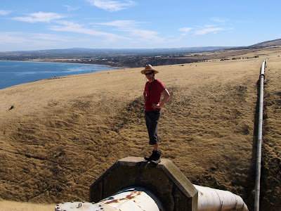
Following the cliff edge didn't last long, we soon headed further inland to the easier route of following a pipeline across farmland. There were numerous steep gullies making their way to the coast, and this route further inland made it a bit easier. There was one particularly steep gully, there was no service road for the water pipe to follow. The dry grass was quite slippery, and the weather conditions hot, as we slowly crawled down the gully.

Near Myponga Beach we took the direct route of following a dirt track into town. Myponga Beach is a town that has fascinated me, very small, it is only accessible by dirt roads off of South Road. It consists of two parts, an older area of shack-like houses, and newer houses spreading out over a hill overlooking the bay. There is a single-lane timber bridge that joins the two parts, crossing over a picturesque creek that breaks out to the sea. The beach is small, bounded by rocky headlands at each end.

I had a very refreshing swim, grateful for the cool water after our hot hike. For lunch some of us sat in the shade under bridge, others took advantage of a well sited verandah to get some shade. When a car passed over the bridge though we had to shield our lunches to ensure they didn't get covered in sand as it fell through the gaps between sleepers that formed the bridge surface.

From Myponga Beach we headed north back to Sellicks Beach along the beach. We followed a small hillside path, which soon opened up to follow the huge rocks that formed a rock platform. We crossed a narrow ledge, the cliff soaring above us to one side, a drop of three to four metres on the other. The ledge led to a small sheltered beach, bounded by cliffs, one containing a large cave. Again, I went for another refreshing swim, so picturesque.


We kept following the coastline, it was low tide but we were concerned we may reach a point that was impassable, but as we rounded each headland we soon realised we would easily make it through. From the cliff tops above, a few people had scouted the coast and seen a potential headland that may have been too difficult to get around. This would have meant we would either climb up a gully back to the farmland, or return to Myponga Beach and retrace our farmland steps. I think without low tide this might have been the case.

There were no further beaches until we were quite close to Sellicks Beach, gradually the rocks diminished in size giving way to large, flat rock platforms that were easier to navigate. Since it was low tide, the water was quite flat, a deep blue colour, and the gentlest of breezes blew off of it. I enjoyed the rock hopping, nostalgically reminding me of all those car camping trips exploring rocky headlands. When we reached the final beach, we saw our first land person, a lone fisherman. We had seen a few others in dingies fishing, and a couple of kayakers.

Back at Sellicks Beach, after a welcome swim and cool drink and icecream purchase, we awaited the arrival of the others. Being in the lead of the party, we had seen few of the main group since the ledge and picturesque beach. It seems they were becoming increasingly spread out as they battled their way over the rocks. This wasn't an official Friends of the Heysen walk, just a collection of friends, but we still had radios with us to keep up communication. John Potter, who has been organising these walks, very wisely called the Aldinga Surf Life Saving Club and asked if they could bring some water down to the end of the beach. It seems some were caught out by the very hot weather, and were running very low on water. The SLSC must have got a little confused, because they sent two vehicles, a boat and a helicopter. It later transpired that they thought there were 40 of us, and nine unaccounted for. Really, there were only 21 of us, and only four or five unaccounted for, and of those we knew they were walking along the coast somewhere. Talking with some of the life guards, through binoculars we watched the heli circle walkers, eventually landing on a small rocky beach. This surprised a life guard, who said it must be serious for the heli to land in such a restricted place. I think the two walkers concerned were a little more surprised, to see the heli circle and then land before them. One was suffering a little from the heat, but was otherwise ok, but since it had landed, accepted the offer of a ride back to Sellicks Beach. The remaining three walkers watched as the heli overtook them, leaving them to bring up the end of the walkers.

I waited around for the last three to return, I didn't want them to return to an empty beach. Ralene had taken to the water for a while, swimming some two to three kilometres. She only got back out of the water, somewhat concerned that she had left her pack to be carried by another walker. She described what she had seen underwater. I had been snorkelling at Sellicks Beach back on Australia Day, we hadn't seen much in the shallow water, but what she saw sounded like an snorkelling adventure was called for. So in a couple of weeks time I will be returning to the small sheltered beach just after the rock ledge, having walked from Myponga Beach, this time with a couple of friends and some snorkelling and fishing gear.

I think we all learnt a bit today. I didn't need a lesson in water on hot days, our hike in hot weather in the Flinders Ranges up Mt Aleck had seen us run very low on water some three or four hours before reaching our cars. I would never underestimate the hot weather situation again, so I had 3.75L of water with me today, and had checked out that I could refill in in Myponga Beach. Perhaps others should have done likewise. I still learnt stuff today, talking to the surf life saving club I realised I did not know how many people there were, 17, or 21? Or somewhere in between? This was crucial for determining where people were now and if they needed assistance, and John was out of phone and radio contact.


Download kml file to view in Google Earth or adapt to use as a navigational aid in a GPS unit


Stats

Adelaide to Cape Jervis
Sunday
07/02/2010
Sellicks Beach to Myponga Beach and return
Distance 19.2km
Start Time 8.10am
End Time 3.30pm
Moving Duration 5h3m
Stationary Duration 2h4m
Moving Average 3.8km/h
Overall Average 2.7km/h