A three day canoe trek down the Glenelg River through the Lower Glenelg National Park with Alex and Bec. Highlight (apart from canoeing down an isolated, natural river) was seeing a platypus.
Friday March 6 to Sunday March 8, 2009
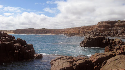
55km, Pines Landing to Nelson, Glenelg River, Victoria
55km, Pines Landing to Nelson, Glenelg River, Victoria
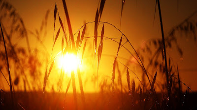
 The platypus is notoriously shy. We saw it one morning as we were packing the canoe the kayak. The river was still, dead smooth, and the platypus emerged amidst bubbles about 8-10m from us in front of the landing, before diving down again. "Shhhh!" as I pushed Bec in the back, this was no time for talk. The platypus surfaced twice more for another look around, before disappearing. Btw that's not my photo, I didn't want to loose the magic of the moment by mucking around with a camera, but this photo is the closest to what we saw that I could find on the internet.
 We took Friday off work, driving down through Mt Gambier on Thursday night after work. We camped at the beach campsite at Piccaninnie Ponds. Next morning we drove into Nelson, and left our car there as the canoe hire guys drove us out to Pines Landing, from where we would paddle back to Nelson over four days. Pines Landing is where we started this little adventure last time I did it. I was struck by how much this place reminded me of that day four years ago, and of Stephen.
 From here we paddled 20km to Skipworth Springs, seeing almost no-one. It took a little while to get the canoe technique right, and we each tried out the kayak and canoe to see where we might fare well. The following two days we improved our technique, improving our 5.0km/h average to 5.5km/h. We paddled hard, only stopping to rest at landings, and not, as previously, at random spots to drift. I think was because this time we had the benefit of the GPS unit, so were able to estimate how much longer we needed to keep up the paddling before the next landing.
Friday was planned to be our longest day, at 20km, with Saturday to be 14km, Sunday 7km and Monday 14km. We had booked the campsites late, not knowing it was also a long weekend in Victoria. So the short 7km day was unavoidable. But on Sunday, we reached our planned campsite at Bowds, 14km downstream. Since it was only 3pm, we decided to paddle the additional 7km to Lasletts, where we had planned to stay Sunday night. Even though we were only staying at canoe campsites, where space was more limited than the car-based campsites, it seemed likely there would still be space for our two small hiking tents.
 Friday night we spent at Skipworth Springs, and had it all to ourselves. Small tents are an advantage at this campsite, as the sites are small since the campground is on a hill. Like all the campsites, there is a toilet, picnic table and at least one fire place. These facilities aren't always marked on the official map, not sure why. There is also rainwater available, except here where there is a natural spring. We hunted down some dry wood, from some dead fallen and not so fallen trees, for a campfire. Victoria is different than South Australia in that fires are permitted during the Fire Danger Season (except on days of total fire ban) and collection of firewood in a national park is permitted. We were visited by the ever fearless possums, who came to our picnic table to clean up our crumbs. For a few moments it looked like we might have a stand-off between two possums, but they resolved their differences and chased each other up a nearby tree.
 Saturday night we camped at Lasletts, this time sharing the campsite with a group of eleven and a group of five. So we didn't get in on either of the fire places, but then we didn't actually have a booking for this campsite anyway. Bec's idea of bringing along a picnic rug, as we chairs were too cumbersome, was a real winner. We set up camp in the corner of the campsite, looking over the river and cliffs. These were the same cliffs that us boys had scaled last time to walk into Nelson to collect Julie's car so she could go home for work a day earlier than the rest of us.
We decided a swim was in order here, yet Alex stated he was off to test the water first. "What? Test the water? Whatever dude." You see, you just don't do that. You decide to swim, if it's nice then that's just a bonus. So Bec and I chatted, and a few moments later Alex emerged soaking wet. I was shocked, he was totally wet. He was surprised as neither of us had heard him bomb it in off the landing. Alex and I returned to the landing where I ran off the end. It was cool, but not freezing, and we both avoided touching the bottom. That night we used my little gas lantern I had found by chance on Friday. I car-camping size gas light with a 2-3kg gas bottle was too big to bring, but this tiny one fitted onto a 300g hiking gas canister, and was much better than a torch.
Now I include a random jaws video, it seemed it wasn't only platypus that occupied the waters of this river.
 Australia being in drought, we weren't sure what to expect with the water level. We were surprised when we arrived in Nelson on Friday morning to find the river high, indeed, very close to some riverbank buildings. The canoe guy told us the river mouth had silted up just a few days previously, so the river wasn't flowing and was backfilling. At Skipworth Springs, the water level was a mere 10cm from the landing deck. Sunday lunchtime we had trouble finding Forest Camp North, another canoe only campsite. The shorter canoe camp landings can be harder to find, as they are simpler structures than the higher car-camping landings and boat ramps. This particular one even more so, the landing deck being about 10cm below the water surface. Last time we were here, I recall Julie rolling around in the mud beside the landing. Throughout the canoe trek we found a few other landings beneath the water surface.
 Monday we paddled the last 14km into Nelson. We stopped at a cliff near Princess Margaret Rose Caves, and climbed part of the cliff to a cave entrance. It turned out this is part of the Princess Margaret Rose Caves network, but has been separated from it by cave-ins. At the main caves landing, we walked up to the shop to grab a cool drink and some food. We hunted around for a while to find a water tank that wasn't contaminated with too much eucalyptus, as Lasletts had also been contaminated.
I recall the stretch from the caves into Nelson as being particularly long and boring, there are not many landings to break up the day. Despite the head wind along Taylors Straight, which slowed us considerably down from 6-7km/h to just 4km/h, bringing our moving average down to 5.2km/h.
Back in Nelson a day early, I took Alex and Bec on their first tour of Mt Gambier's lakes and sink holes, before we returned to Piccaninnie Ponds to camp. We had the campsite to ourselves this time, or so we first thought, before the late night disturbances began. The pubs/nightclubs of Mt Gambier must have closed around 12-1am, as after that until dawn the car park near the beach was hoon central.
After a quick swim in Piccaninnie Ponds on Monday morning - well it was cold and Alex was a poopy head and didn't want to come for a swim so it's a pretty short one - and some yummy pancakes with Nutella, we returned to Adelaide. We stopped off at Bool Lagoon for a look-in, perhaps we could return here and camp for a weekend and do some bird watching, but despite the apparently recent photo on the RAA map, the lagoon was dry with no surface water. We wondered if it might fill a little in winter?
Download kml file to view in Google Earth or adapt to use as a navigational aid in a GPS unit |
Nelson Boat and Canoe Hire
Chris and Cheryl
(08) 8738 4048
www.nelsonboatandcanoehire.com.au
The canoe hire was $45 per day, and the kayak $40 per day, with a $40 drop off fee to Pines Landing - total cost $295. My car was securely stored in Nelson.
| Stats | Glenelg River | ||
| Friday | Saturday | Sunday | |
| 6/3/2009 | 7/3/2009 | 8/3/2009 | |
| Pines Landing to Skipworth Springs | Skipworth Springs to Lasletts | Lasletts to Nelson | |
| Distance | 20.3km | 22.6km | 14.8km |
| Start Time | 9.58am | 10.22am | 9.35am |
| End Time | 4.24pm | 4.53pm | 1.59pm |
| Moving Duration | 4h2m | 4h5m | 2h51m |
| Stationary Duration | 2h12m | 2h25m | 1h34m |
| Moving Average | 5.0km/h | 5.5km/h | 5.2km/h |
| Overall Average | 3.2km/h | 3.5km/h | 3.3km/h |
| Maximum Speed | 8.1km/h | 8.1km/h | 7.7km/h |
| Oodometer | 20.3km | 42.8km | 57.6km |