Showing posts with label 2008. Show all posts

Wednesday, January 7, 2009

233km in Tasmania

Tim, Kate and myself have just returned from doing 17 days/233km of hiking in Tasmania.


Hiking in Tasmania really is something special. There are so many trails and places to camp, and with an all-parks pass it is very cheap. I could live here someday, for a time at least. Maybe based in Hobart. With more research I could come up with a comprehensive list, but for now I can say I would like to hike up Mt Wellington - I drove up here but forbid myself from walking the distance of several metres from the carpark onto the adjacent Pinnacle (the peak of Mt Wellington) in favour of saving the moment until I had hiked up the mountain from much lower down. I would also like to spend a weekend camping and hiking on Bruny Island, a week or so hiking the South West Track, Maria Island, Flinders Island and more time exploring the Walls of Jerusalem National Park.

Over the past three weeks these are the hikes we have done:


We used Lonely Planet's Walking in Australia guide which is well recommended for it's excellent maps and walk notes. Borrow or buy the book, or alternatively download a pdf of just the Tasmania chapter for as little as $8 from the Lonely Planet website.

I also spent some time around Launceston, visited Bruny Island, camped at Binnalong Bay on the Bay of Fires and explored Richmond.

Friday, January 2, 2009

Bay of Fires

"White beaches of hourglass-fine sand, Bombay Sapphire sea, an azure sky - and nobody," Lonely Planet's Best in Travel 2009 guide (formerly The Bluelist) says. "This is the Bay of Fires: the secret edge of Tasmania, laid out like a pirate's treasure map of perfect beach after sheltered cove."

Bay of Fires, Mt William National Park, Tasmania
3 day hike, Wednesday 31 December 2008 to Friday 2 January 2009


Lonely Planet may be a defining influence on where traveller's visit, but these words published just last November had yet to reach their full impact. The beaches were still empty of people. Lonely Planet published this destination in their Top 10 Regions of 2009, the only Australian entry. View the article from Lonely Planet's Best in Travel 2009 guide.


News report from ABC1's 7.30 Report, aired on 25 November 2008

Prior to commencing our hike, we camped at Binnalong Bay at Cosy Corner in a crowded car-based campsite. It was a stunning beach though.

We left our car outside the former general store in Ansons Bay, from where our pre-arranged taxi took us to the start of our walk at Top Camp, in Mt William National Park, the camp being accessed through the shack town of Musselroe Bay (taxi: East Coast Taxis, based in St Helens, 0417 513 599, 03 6376 2999, $90 on the meter). It was hot but windy, not a promising start to a long beach walk. Thankfully though, it was a tail-wind, I think it would have been miserable if we had been walking into the wind. As it was the wind would collect the sand up and throw it at your legs and face like a thousand needles.

We camped at the 4th Stumpy Bay campsite, finding it an ideal haven from the beach wind. A pleasant river setting with grassed areas beside the picnic area, it was here that we spent our New Years Eve. I was adament to spend some time on the beach late afternoon, but the wind was fierce and unrelenting.

The following day the wind had subsided somewhat, and we walked a further 15km to the Deep Creek campsite. There were many beautiful beach spots today, with stunning red boulders and rock reefs. We were treated to a special sunset and evening swim. The following morning we swam again, this time putting the snorkel and mask I had carried on my pack to use. The conditions weren't ideal for snorkelling. All the people I had seen in recent days snorkelling had been wearing full wetsuits. As it was, it wasn't the lack of a wetsuit that would be our undoing, it was the brain freezie created on the outside of our heads as we swam headfirst through the cold water.

The entire walk except the final 3km was on beach or climbing over rock headlands. At Deep Creek campsite we discovered a map of a trail that went from Mt William, at a paltry 217m above sea level, to Kangaroo Forester Drive, then to just down the road to Stumpys Bay #4 campsite and then following the coast to Cobler Rocks. It would have been good to follow the short section along the coast, although the coast there was quite good.

Just 600 metres from the car, still amidst bush and walking along a sandy track with no sign of the car yet, Kate firmly declared that she was now over walking having walked the past 3 weeks. Lucky the track emerged into Ansons Bay and the car promptly afterwards.


Download Google Earth KML file of Bay of Fires hike
Download kml file to view in Google Earth or adapt to use as a navigational aid in a GPS unit


Stats

Bay of Fires
Wednesday Thursday Friday
31/12/2008 01/01/2009 02/01/2009
Top Camp to Stumpys 4 Stumpys 4 to Deep Creek campsite Deep Creek campsite to Ansons Bay
Distance 7.8km 14.3km 14.4km
Moving Duration 1h47m 3h13m 3h14m
Stationary Duration 47m 1h53m 1h39m
Moving Average 4.4km/h 4.4km/h 4.5km/h
Overall Average 3.1km/h 2.8km/h 3.0km/h
Oodometer 204.7km 219.0km 233.5km

Tuesday, December 30, 2008

Freycinet Peninsula

Walking along a picturesque beach, followed by a picturesque beach to camp at. Swim at another picturesque beach, followed the next day by another picturesque beach to camp at. Who could ask for more?

Freycinet Peninsula, Tasmania


What more is there to say? The first day we negotiated the edges of the Hazards - a collection of mountains named after a ship not their hazardous nature - to Hazards Beach. From here we walked a couple of kilometres along the hard sand - careful not to walk too high on the beach so as to crush the bird eggs or indeed the sand-coloured baby birds if there were any - to Lugunata Creek campsite. Just short of here we had finally caught up with the two parents and seven year old girl we had briefly spoken to in the carpark. The girl was running ahead of the parents and gaining some extra mileage with her wanderings, so I think she would be just fine on her first multi-day hike.

We walked inland to Cooks Beach where we found the clearest of waters as the waves crashed across the pure white sand. After a swim, who could resist, we sat on the beach and read as the sun set before us.

We started day two with a short 1 hour return walk to Byrans Beach, can you beleive it, yet another picturesque beach? This one was off the main track, but the campers there looked just like car campers. Big tents, shade covers, toilet tents and shower tents, and lots of washing strung up. Were they all wandering around naked somewhere, or perhaps, more likely, they had come here by one of the several boats anchored along the sheltered beach. Their camping style stood in stark contrast to that of the previous night where twenty or so campers set up camp, having carried their tents and gear in on their backs.

Returning to Cooks Beach, we began our arduous climb from sea level up 579 metres of Mt Graham. From here, in the hot sun, we had a postcard view of the isthmus joining the end of Freycinet Peninsula to the Hazards and the mainland. Ont he left was yesterday's Hazards Beach, and the right, the famous Wineglass Bay. It was a slow steady descent down to Wineglass Bay and our campsite. The long descent put somewhat of a dent in the seven year old's enthusiasm. She had discovered the hiker's secret: maybe just maybe we prefer the hard ascending hikes to the long descending ones?

The campsite vibe here was a little different. There were numerous boats anchored in the sheltered bay, but this time none were camping. However the campsite was strewn with rubbish and empty bottles, and the toilets were, what shall we say, feral. After we had set up camp, a young couple walked off the beach and into the campsite, clearly having walked the short one and a half hours from the carpark, the distance we would complete the following day. "Where's the bin, I can't see it anywhere," the girl was overheard to ask the guy. "Let's ask," he replied. Mmm. There isn't one. Is it too much to ask to carry out what you carried in, after all, it is a lot lighter without the contents. We later saw them heading off in the direction of the toilets with a bag of rubbish, complete with the toothpaste box from their newly purchased toothpaste. Needless to say, they returned empty handed. The eco toilets they have at the campsites throughout Tasmania are very good, they are waterless and just require one to empty a scoop of rice husks from an adjacent bin after you have finished your business - this controls the smell. Here at this campsite through, the rice husk bin, one of those plastic bins we all used to use kerbside in the '80s was overflowing with rubbish, the rice husks long buried. It was disappointing.

During tea we were visited by several paddymelons - a kind of wallaby us South Australians had never heard of before our visit. The young ones can be just as brave to approach us. Later we sat on the beach listening to the gentle lapping of the waves before a late rain shower saw us retreat to our tents to make some hot chocolate.

The following day we made the short hike back to the carpark via the beach on Wineglass Bay and the Wineglass Bay lookout. Many people make the short return hike to the lookout, or venture further to the beach, or the loop via Hazards Beach and return via the Hazards. These day walkers greatly outnumber the multi-day hikers, and several kids were heard to ask about our large packs or my curious trekking poles. I wouldn't have objected if they carried my heavy pack for a few hundred metres, but no offers were forthcoming.

The end of a three day hike and heavy rain in the carpark as we packed up the car ensured we gave up on any ideas of climbing Mt Amos for an even better view of Wineglass Bay. Again, we chatted to the parents with the seven year old child. It doesn't seem to matter how slow you walk, just as long as you keep going and going - they were never much slower than us fast walkers. There's a lesson there somewhere I'm sure.


Download Google Earth KML file of Freycinet Peninsula hike
Download kml file to view in Google Earth or adapt to use as a navigational aid in a GPS unit


Stats

Freycinet Peninsula
Sunday Monday Monday Tuesday
28/12/2008 29/12/2008 29/12/2008 30/12/2008
Carpark to Cooks Beach Cooks Beach to Bryans Beach and return Cooks Beach to Wineglass Bay Wineglass Bay to carpark
Distance 14.0km 5.9km 12.9km 4.5km
Moving Duration 2h57m 1h5m 3h34m 1h4m
Stationary Duration 1h1m 1h 1h50m 22m
Moving Average 4.7km/h 5.4km/h 3.6km/h 4.2km/h
Overall Average 3.5km/h 2.8km/h 2.4km/h 3.1km/h
Oodometer 173.5km 179.5km 192km 196.8km


There is limited water available on the track. There are rainwater tanks at Cooks Beach Hut, although an older tank there was infested with crawlies of some sort. There were creeks on Day 2, as marked on the map, and no rainwater tanks at Wineglass Bay campsite.

Saturday, December 27, 2008

Cape Pillar Track

Sheer cliffs fell 280 metres away to the sea below from the Blade and Chasm Lookouts. Both exposed promontories rise sharply above the surrounding landscape.

Cape Pillar Track, Tasman National Park, Tasmania
3 day hike
Thursday 25 December to Saturday 27 December 2008


Beyond the two promontories lay Tasman Island, complete with lighthouse and 3 houses set high above the sea, the island surround by high cliffs. All I imagine, is abandoned, probably complete with furniture since the day the lighthouse was automated.

We spent 3 days in this section of the Tasman National Park. On Christmas Day we set out from the camping area at Fortescue Bay loaded with 13.5L of water between us, a special Christmas dinner and some wine. We found a very un-shy echidna on the trail, which Tim made a vid of.


It was a hard climb in the hot sun to Cape Huay junction, where we dropped our packs for the walk out to the Totem Pole and Candlestick on Cape Huay. It was so huge, this freestanding pillar of stone, it was difficult to capture on camera.


Back on the main track, it was a hard slug up the overgrown track to Mt Fortescue at 490m above sea level. Beyond the peak we reached Wughallee Falls where we found a rather unprepared hiker. His tent was set up on the narrow track beside the falls, despite it being clear that he knew the campsite was only 150m further and had ample camping spots available. When I returned the following day for a wash, I collected his rubbish, it would have been nice to have seen him again to return it to him. It had taken us 6 hours to reach camp, we had left later than planned, so we ate a late tea and went straight to bed pledging for a lie-in the following morning.

Leaving our tents set-up, and our packs behind, we set off on the return walk to Cape Pillar. It was beautiful, although really we only kept seeing the same thing again and again just from a closer viewpoints. A comment on the walk registration book at the junction amused us, "not enough trees across the path, please add more." Some track maintenance of the Fortescue Bay to Tornado Ridge section was certainly in order.

On the final day we hiked out for just 1.5 hours across the flat swamp back to Fortescue Bay and the car, from where we visited Port Arthur before heading up to Coles Bay for an overnight stay in the caravan park.


Download Google Earth KML file of Cape Pillar Track hike
Download kml file to view in Google Earth or adapt to use as a navigational aid in a GPS unit


Stats

Cape Pillar
Thursday Friday Saturday
25/12/2008 26/12/2008 27/12/2008
Fortescue Bay to Retakunna Creek Retakunna Creek to Cape Pillar and return Retakunna Creek to Fortescue Bay
Distance 13.2km 18.0km 7.3km
Moving Duration 3h46m 4h37m 1h29m
Stationary Duration 2h11m 2h30m 17m
Moving Average 3.5km/h 3.3km/h 4.8km/h
Overall Average 2.2km/h 2.5km/h 4.1km/h
Oodometer 124.7km 142.7km 150.0km


There is limited water available on the track. There was water in Retukunna Creek, but brackish. We filled up with water at Lunchtime Creek. There are no water tanks.

Tuesday, December 23, 2008

The Overland Track: Entry #3 (of 3)

The five of us - Tim, Kate & myself and Andrea and Theo - have camped together for the previous 4 nights, and we have climbed Mt Ossa together. We have been doing everything together.

The Overland Track, Tasmania
6 day hike: this blog entry the 5th, 6th and 7th days
Sunday 21 December to Tuesday 23 December 2008
Kia Ora Creek to Pine Valley Hut to Narcisus Hut to Cynthia Bay


We had lunch on a tent platform at Windy Ridge Hut, a one-point something million dollar hut that no-one seems to stay at, instead having lunch there. From there we walked halfway to Narcissus Hut before taking a sidetrip to Pine Valley Hut. From Pine Valley we hoped to climb the Acropolis, some of our eager members hoped to walk that afternoon, allowing time the following morning to explore the Labyrinth. By lunch my feet had declared climbing the Acropolis that evening as a non-option.

As it turned out, the hike of 1.5 hours off the main track was exhausting and Pine Valley Hut couldn't come soon enough. The walk out to the main track the following day we found to be quick and easy - a sure sign of how exhausted we were the previous afternoon. The campsites at Pine Valley Hut were small and sheltered, with rain forest soaring high above us and a creek meandering through the campsite.

The morning of the 6th day, Tim, Theo and myself set off to climb the Acropolis as the girls had a well deserved sleep-in. The Lonely Planet guidebook said it was a 4 hour return walk, but the sign in the hut said it was a 5 to 7 hour return walk. We didn't have heaps of time, so decided to be back at the hut within 4 hours. The ascent to the midway plateau was very steep, and we reconsidered if we would still have time to make the peak from there. We decided to cross the plateau and reassess the situation. The Acropolis loomed closer, and with Tim's optimism it seemed to be close enough to achieve. There were a few difficult sections, but all in all it was easier than Mt Ossa had been. Again the peak was a plateau, and we had magnificent views of Mt Geryon and down to the Labyrinth. Despite the wind, we made our obligatory contribution to XXXXXXXXXXXXX (more details later) and returned to Pine Valley Hut. The final descent was steep and very hot, so I quite enjoyed my splash around in Cephissus Falls. We made it back to the hut in 4 hours and 4 minutes, where Kate and Andrea had prepared lunch.

The hike to Narcissus Hit was quite easy and flat. After confirming our ferry booking for the following morning via radio-speak in the hut, we set up camp beside the river. There were no tent platforms tonight, and despite the river it was a hot shadeless campsite. Once again Andrea got to see a snake as it crossed out campsite.

The following morning we walked the 300 metres to the ferry for the short trip to Cynthia Bay, where we all ate breakfast in the cafe before the bus trip to Hobart.


Alternatively, visit the Overland Track website to view the official Google Earth kml file. Download kml file to view in Google Earth or adapt to use as a navigational aid in a GPS unit


Stats

Overland Track:
Days 5-7
Sunday Monday Monday Tuesday
21/12/2008 22/12/2008 22/12/2008 23/12/2008
Kia Ora Creek to Pine Valley Hut Pine Valley Hut to Acropolis and return Pine Valley Hut to Narcisus Hut Narcisus Hut to Cynthia Bay
Distance 19.3km 6.5km 8.8km 300m (the rest by ferry)
Moving Duration 4h47m 1h53m 1h51m
Stationary Duration 1h13m 1h24m 24m
Moving Average 4.0km/h 7.3km/h 4.8km/h  
Overall Average 3.2km/h 1.9km/h 3.9km/h  
Oodometer 96.2km 102.6km 111.5km  

Saturday, December 20, 2008

The Overland Track: Entry #2 (of 3)

It was some climb to Mt Ossa, 4 hours return, and we weren't quite sure which mountain it even was. Was it this one in front of us (it was huge), or was it one looming behind somewhere?

The Overland Track, Tasmania
6 day hike: this blog entry the 4th day
Saturday 20 December 2008
New Pelion Hut to Kia Ora Creek


After climbing 150m from the main track up towards Mt Ossa we asked a passing tour guide who was bring his group back down. Yep, we couldn't see it yet, it lay behind the distinct mountain we could see before us. We had to go up, where we could re-evaluate.

"We've only climbed 300m, we still have 200m to go," I said to the others. "Yeah, we've climbed 300m, only 200m to go," replied Tim, ever the optimist. On we climbed up this mountain through a gully between two larger pillars of rock. It wasn't easy, I gotta tell you I was scared when I looked down. At the top of this formation I sat admiring the view. "I'll climb up there," I said, "it looks easy enough. From there we can see how much further it is to the peak." By this time Andrea and Theo had caught up with us, and Tim and Theo set off up the next ascent. I asked someone coming down how much further it was - I hate asking that - and it quickly became apparent that it was Mt Ossa that lay before us. So I raced up after the other two guys, climbing up through the snow patches, to reach the summit of Mt Ossa. The summit is a plateau, hence our reasoning as to why it wasn't Mt Ossa.


It was such a clear day we could see everywhere, and this being Tassie's tallest peak at 1617m, we were rewarded with views of peaks everywhere. I made a contribution to Theo's friend's website - a website Theo and his friends had all put in together for to pay for the programming and set-up costs as a birthday gift. Perhaps more on that later.

The descent was quick, just 45 minutes, and despite how scary the ascent was it was easy to return back down. We arrived at camp at 6pm at Kia Ora Creek, our tent platforms placed overlooking the creek with the sun setting on a distant rock face. After a refreshing swim - the waterfall was icy cold - we all ate dinner together and talked with the park ranger Jenny.


Alternatively, visit the Overland Track website to view the official Google Earth kml file. Download kml file to view in Google Earth or adapt to use as a navigational aid in a GPS unit


Stats

Overland Track: Day 4
Saturday
20/12/2008
New Pelion Hut to Kia
Ora Creek
Distance 14.4km
Moving Duration 3h45m
Stationary Duration 3h36m
Moving Average 3.8km/h
Overall Average 2.0km/h
Oodometer 76.8km

Friday, December 19, 2008

The Overland Track: Entry #1 (of 3)

It's the buttongrass. And the water. I'm sure of it. This is what makes this place so special. Almost fairytale.

The Overland Track, Tasmania
6 day hike: this blog entry the first 3 days
Wednesday 17 December to Friday 19 December 2008
Ronny Creek to Waterfall Valley Hut to Windermere Lake to New Pelion Hut


The Overland Track, it's a Designer Trail I tell you. Well, that's what I thought on the first day anyway. A shuttle bus to the start, boardwalks and graveled pathways, all through swamp, lush rainforest, lakes and mountaintop panoramas. But it ends, in mud, amongst the remnants of thirty year old rotten timber walkways. Water is everywhere it seems - always in abundance on the muddy track - but also in streams and lakes. For a South Aussie, it is at first unnerving only carrying 1L of water, but it seems everytime my drink bottle came close to empty another source of wonderfully clear water appears.

The view of Cradle Mountain on climbing to Marions Lookout is quite something, after a hard ascent the mountain suddenly appears before you. We were very lucky with clear skies, bad weather is common here it seems.

Day 1 ended at Waterfall Valley Hut, where we camped on the timber platforms above a waterfall. Andrea (pronounced On-dri-ah) and Theo, who we first met on the bus from Launceston, camped with us. Whilst we chatted, a couple of small spotted quolls explored our tents. None of us were too sure about how to set up our tents on the timber platforms with the cables instead of tent pegs. The strategically placed cables, and sometimes not so strategically placed, weren't so easy to master. How to keep the tension so the tent would remain waterproof if it rained. Luckily the first night it didn't, and by our second night we had learnt a bit because it not only rained, but snowed. The snow was special, it not so much fell as floated down onto our tents. At 4am when it started, I didn't care too much as the possums had been busy searching out food. But waking again later to a tent burdened with snow, I snuck a look to confirm my suspicions.

The view at the end of day 2 coming down to Windermere Lake was breathtaking, the yellows and purples. We saw two wombats, one crossing our path quite undisturbed by us.

Day 3 was longer at 17km. The view of Mt Oakleigh held us spellbound all day as we walked in a large arc around it. There was a lot of mud on this day, so our new gators were well used. They are so hot and uncomfortable which is why I hiked they whole Heysen Trail without any. Eewwk. But they are practical in the wet.

Tim and I went for a swim in Douglas Creek near the Old Pelion Hut. It was about a 20 minute walk from the new hut, maybe shorter if Tim hadn't worn his crocs there. The trail to the old hut was in very bad condition, but new timber materials lying stacked around indicated it was soon to be replaced. I think perhaps Tim needed the 4WD crocs we saw the park ranger Matt have earlier in the day. The swim was cold, but well worth it.

Again we camped with Andrea and Theo, the spotted quoll providing more amusement. The quoll soon lost interest in our tents, and upon hearing a group of guys playing hackie in the distant, it climbed upon a log to get a clearer yet distant view. Very amusing to watch.


Alternatively, visit the Overland Track website to view the official Google Earth kml file. Download kml file to view in Google Earth or adapt to use as a navigational aid in a GPS unit


Stats

Day 1-3: The Overland Track
Wednesday Thursday Friday
17/12/2008 18/12/2008 19/12/2008
Ronny Creek to Waterfall Valley Hut Waterfall Valley Hut to Windermere Lake Windermere Lake to New Pelion Hut
Distance 11.8km 11.0km 14.6km
Moving Duration 3h20m 2h35m 3h41
Stationary Duration 1h48m 1h04m 1h49m
Moving Average 3.5km/h 4.3km/h 4.0km/h
Overall Average 2.3km/h 3.0km/h 2.6km/h
Oodometer 36.8km 47.8km 62.4km

Monday, December 15, 2008

Walls of Jerusalem

Pure Tasmania. Who can argue with that? Tim tied his cup to the outside of his pack so he could drink from any stream that took his fancy.

Walls of Jerusalem, Tasmania
2 day hike: Sunday 14 December to Monday 15 December 2008


One stream did taste awfully like rocks, but the rest were refreshingly cool and good, indeed pure. Accustomed to hiking in South Australia, we asked someone at the hostel the night before we left about the availability of drinking water at campsites. He had taken a similar route through the park just days previously, and assured us there was plenty of water. But quite frankly, we didn't get it. Water, everywhere? Nah mate you've got to be kidding. Seriously though, it truly was. Pure water, everywhere.

The hike from the car park to Trappers Hut and the junction wasn't too tough, despite the 600 metre ascent. I was finding it harder than I expected though, thanks to a lingering bout of influenza of which the effect of fatigue I was still feeling. I guess it created a level playing field as it brought me back to Kate's speed. Sweet justice.

From the Y-junction the views were magical. It's hard to explain, a path winding through towering cliffs with streams and lakes, ferns and moss. Likewise, the Pool of Bethesda were magical.

We camped at the end of the marked trail at Dixons Kingdom Hut. For tea we ate a pasta meal and mash, and experimented with making custard without the aid of the instructions. Needless of say, despite adding more milk powder we established that it was somewhat inedible. But what to do with it? We couldn't leave it in this pristine environment, but hey Tim did his duty. This place was so beautiful and pristine it didn't even feel right to piss anywhere.

The following morning we bush bashed following our Lonely Planet guide instructions, occasionally coming across a path to lead us, only to lose it later. Lake Ball was the perfect swimming lake with grassy edges and a rock and moss lakebed. Pity it was still so cold. Later, from Lake Adelaide the walk got quite muddy as we hiked through swamp. Gators were definitely on the shopping list for when we returned to Launceston.


Download Google Earth KML file of Walls of Jerusalem hike
Download kml file to view in Google Earth or adapt to use as a navigational aid in a GPS unit


Stats Walls of Jerusalem
Sunday Monday
14/12/2008 15/12/2008
Carpark to Dixons Kingdom Hut Dixons Kingdom Hut to carpark
Distance 10.6km 14.4km
Moving Duration 3h12m 3h41m
Stationary Duration 2h27m 2h11m
Moving Average 3.3km/h 3.9km/h
Overall Average 1.9km/h 2.4km/h
Oodometer 10.6km 25.0km

Saturday, October 18, 2008

Trailblazer 2008

10:59 we named our team, that being our goal to do the 50km event in that time. We almost did, but easily made it in before sunset - 11h39m.

The Trailblazer Challenge
50km: Adelaide Oval to Mt Lofty summit


Like last year, it was hot, about 33 degrees. But this year, it was a generally overcast day, so that made it feel a lot cooler. After a good start at the starting archway - due to the congestion we walked around it rather than through it thereby giving ourselves a good headstart - we made good progress along the first 18km to Athelstone.

On the next stage to Morialta, Tim and I discovered just how much fitter we were than this time last year, we hiked from Gorge Road up Ambers Gully up to the fire track (from which you can see Black Hill) without stopping once. Woah dude. Felt good.

The stage through Horsnell Gully up to the radio tower checkpoint was as tough and unrelenting as last time, not because it is particularly steep but because it just goes on fooorever. From the radio tower checkpoint to Mt Lofty summit is always a pleasant walk, the sun was getting lower and filtered through the tall forest trees creating a spectacular sight, whilst being a shady walk.

Kudos to Kate for picking us up at Mt Lofty, armed with a selection of cold beers. Sweet as.


Monday, October 6, 2008

On its best behavior

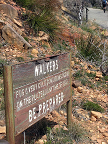
Walkers: fog and very cold conditions occur on the plateau anytime of year. Be prepared.

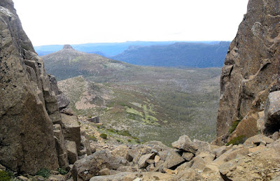
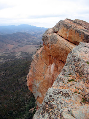
ABW Grampians trip - Major Mitchell Plateau

Translation, cos really, I've never seen a sign like this before whilst hiking, basically Plateau Subject to Alpine Conditions. Really? Yup. An unprotected windswept high plateau can be pretty bloody cold. But, Major Mitchell Plateau was on it's best behavior. Sunny days which seemed warm, despite the vapour coming from our mouths (turned out it was 9 degrees on Saturday during our plateau ascent). Simon declared it was the coldest he had ever slept (that's a big call for him), turned out it was 0.2 degrees overnight, one of his water bottles froze. But there was no wind, so really, the weather was perfect, indeed on our descent it turned windier (very very cold wind) and Monday morning it rained, as we were on the bus leaving the Grampians the plateau was shrouded in dense fog.

Amazing views. Excellent camping, so weird to camp next to flowing creeks. So much water. The Grampians and me are gonna make good friends.


Stats:
Saturday
  • Distance: 13.2km
  • Start time: 8.42am
  • End time: 3.52pm
  • Moving duration: 4h 12m
  • Stationary duration: 3h 04m
  • Moving average: 3.1km/h
  • Overall average: 1.8km/h
  • Max speed: 10.9km/h
Sunday
  • Distance: 14.6km
  • Start time: 8.59am
  • End time: 4.23pm
  • Moving duration: 4h 29m
  • Stationary duration: 2h 47m
  • Moving average: 3.2km/h
  • Overall average: 2.0km/h
  • Max speed: 7.2km/h

Sunday, August 17, 2008

The Heysen Trail - Complete

Yesterday I finished the Heysen Trail at Parachilna Gorge - a journey of some 1,200km from Cape Jervis. 64 days of hiking over the past 2 years.


Finished - August 16 2008 - at the end of the Heysen Trail at Parachilna Gorge

It seems a long time ago now, that fateful day when I started - April 30 2006. That morning was cold, I almost didn't bother getting up early.

It didn't go unnoticed today of my first End-to-End 2 weekend back in mid May 2006 when I hurt my knee on my first hike with that group. After six months or so of physio exercises, and lots of hike-bandaging and poles - well, let's just say I've come a long way since then.

It seems so surreal that I have finished the trail now, I can't imagine not doing it anymore. I might walk some days on the trail again with people, it may not be so easily done to untangle oneself from the trail. However I probably won't blog them here.

There may still some unfinished business looming with the Heysen Trail next year though, I'll get back to you on that one later. Secret squirrel.

The full blog of my 64 days on the Heysen Trail can be found here: www.jez-heysen.blogspot.com

Saturday, August 2, 2008

Finishing the Yurrebilla

It's been some 11 months since the last stage - gosh, it's only a 3 day walk - but now we have finally completed the last section of the Yurrebilla Trail.

Eagle on the Hill to Belair National Park


Enjoyed walking up Brownhill Creek, and the bits around Eagle on the Hill were quite pleasant. Tim was our tour guide for this bit, a wealth of information in him. I'm writing this a week later, so frankly, I've got nothing else to add.


Stats:
  • Distance: 14.8km
  • Start time: 10.10am
  • End time: 1.30pm

Sunday, June 29, 2008

Then there were four


The fast, medium and slow groups didn't eventuate, and by the morning break Graham and I decided to form a breakaway group that would be fast. With the walk leader's approval the seven of us set off, however by lunch time only four of us remained, the rest dropping back to the main group.

Pioneer Womens Trail: Hahndorf to Beaumont


The trail honours the pioneer women of Hahndorf who took their produce to the markets in Adelaide from their homes in Hahndorf, between 1839 and 1852. They carried up to 65kg, and walked barefoot, setting off at 1am to make Beaumont by early morning and the city markets after that.

Listen to an interview with Anni Luur Fox from the Hahndorf branch of the National Trust, which aired on ABC 891 on Friday.


Stats:
  • Distance: 28.4km
  • Start time:
  • End time:
  • Moving duration: 4h 50m
  • Stationary duration: 1h 12m
  • Moving average: 5.9km/h
  • Overall average: 4.7km/h

Saturday, June 28, 2008

Just 4 minutes rest

Returning to the Waterfall Gully hike, we got our best rest time ever - just 4 minutes.

Mt Lofty Summit to Waterfall Gully and return


Monday, June 9, 2008

Does the wind count?

It didn't rain today, unless if you count when the wind blows while you are standing under trees.

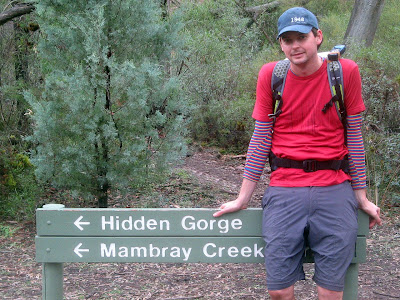
Hidden Gorge, Mambray Creek


Our Heysen Trail walk was cancelled today due to wet roads, so Graham and I drove down to Mambray Creek - thank goodness for the car hey - and walked the Hidden Gorge hike. It didn't rain.

Pretty glad we went for the walk though, 16.9km over 5 hours. Hidden Gorge was magnificent, we even saw a Yellow Footed Wallaby with a striped yellow tail. Graham and I both took falls on the slippery rocks through Hidden Gorge.

This was a special hike, this is the same hike I did with the guys when I was 17 over a hot Easter, I guess one of my first hikes, certainly the longest I had done before. Back then we did in jeans or trackies with some regular backpacks and water bottles. How it changes ha?

Back on the Heysen Trail tomorrow.


View photos as full screen slideshow


Stats:
  • Distance: 16.9km
  • Odometer: 41.49km
  • Start time: 8.20am
  • End time: 1.24pm
  • Moving duration: 3h 46m
  • Stationary duration: 1h 15m
  • Moving average: 4.5km/h
  • Overall average: 3.4km/h
  • Max speed: 10.5km/h

Saturday, June 7, 2008

Exhiliration

An adrenalin climb to breathtaking views after views. A short, hard hike, some rock scrambling but views that just take your breath away.

Devils Peak, Pichi Richi Pass


I drove up to Port Augusta today for the first week of two for End-to-End 2 week on the Heysen Trail, from Quorn to Moralana Scenic Drive, near Wilpena Pound. So for something to get me in the mood (like I need to) I drove out to Quorn to hike Devil's Peak. A quick but good hike that I had never done before.

Euphoric as I was having reached the top, scrambling up rocks, at the same time I got an sms from Alex to say he was engaged, so a quick phone call from what he said was the best place called from yet to congratulate him.


View photos as full screen slideshow


Up Stats:
  • Distance: 1.24km
  • Start time: 2.00pm
  • Moving duration: 25m 30s
  • Stationary duration: 12m 30s
  • Moving average: 3.2km/h
  • Overall average: 2.1km/h
  • Max speed: 7.5km/h

Coming back down was just 20 minutes.

Wednesday, May 21, 2008

10,000 steps each day

Tomorrow I start the 10,000 steps a day challenge with others from my workplace. So for the next 4 months I am going to be ridiculously annoyed by having to wear a pedometer.


The event runs for until September, and each of the two Adcorp teams will be competing against each other and other Adcorp teams across Australia.

The GCC is a corporate health and wellbeing initiative developed specifically for the workplace. The event was created to address the emerging health crisis resulting from the triple threat - longer workdays, sedentary occupations and little or no exercise.

As you will discover, the GCC is a program that increases staff fitness, promotes teamwork, fosters positive competitive spirit, and supports the workforce to be active, healthy, and more productive.

Most importantly, it's fun. Participants record their daily walking activity levels from their GCC pedometer and every step moves them further along a virtual walk around the world. With a daily target of 10,000 steps and a journey that provides reward for effort, participants and their team have a great time while maintaining the long-term commitment and motivation needed to bring about positive, habitual change.


Website: www.gcc2008.com

My pedometer is here
It’s everywhere that I do go,
It comes with me in sunshine,
And through the rain and in the snow.

I wear it on my hip
Making sure it’s set up straight,
That way it keeps my step count right
Regardless of my gait.

Not on my head or by my toes
But just there on my hip,
And if I wear loose clothing
I need to check it doesn’t slip.

And the days I have to wear it
Well, that’s everyday I’m told,
Every weekday and weekend
To my body it must mould.

Except when I go swimming
Have a bath or get undressed,
Cause if we had to wear it nude
We’d all get rather stressed.

It cannot measure everything
Of this, I am aware,
It doesn’t measure street luge miles
Or wrestling with a bear.

But what it does is measure steps
And how many I can do,
I can’t wait to get it started
And we hope you can’t wait too.

Sunday, May 18, 2008

54 Seconds

The 54 second stop on the way downhill rests squarely on Kate and Tim's shoulders. They were slow, I had to wait for them - twice - otherwise the stop time would have been zero.


After a 6 week break - where I have been hiking or away - we returned to our training route of Mt Lofty Summit to Waterfall Gully. We did well, although I was a bit sore the next day. Not sure what was going on there? Evidently the hiking over the past 5 weekends was not enough... not sure, it could have just by evil body. (the last 5 weekends - to justify: April 25 - camping, April 13 - ABW hike, April 20 - Heysen Trail catch-up hike, May 4 - Heysen Trail catch-up, May 11 - Heysen Trail catch-up)

Anyway, a nice latte at the top today.

Sunday, April 13, 2008

Newbies trying out Adelaide Bushwalkers

An easy weekend doing some pack-carrying hikes - ideal for beginners - with Adelaide Bushwalkers

Kuitpo Forest


Since I have only done one hike with Adelaide Bushwalkers (ABW) before, back in July in Mt Remarkable National Park, and with the new hiking season just started, I thought I would join in on this "beginner's hike". This year I'm doing two weeks with the Friends of the Heysen Trail, but apart from that only 3 other walks with them, and a handful of catch-up walks with friends so I can finish the Heysen Trail on August 16. So I will have more weekends available to hike with ABW, especially after August. I quite enjoy pack carrying, and camping out overnight. Also, there seem to many more young people in ABW than in the Friends of the Heysen Trail.

There were eleven of us, 6 beginners - Debbie, Joyce, Sam, Liz & Steve, and myself (who had hiked once before with ABW) - and the rest regulars. Debbie, Joyce and Sam were all pretty new to pack-carrying and camping out overnight. It was great to meet so many newbies, and I think they found much comfort in each not being the only one.

The hikes were fairly easy, only 3-4 hours each, although a little faster than I would normally walk with a pack. Of course the newbies found them more difficult, carrying a full pack isn't easy. There is also very little in the way of hills around Kuitpo Forest. On Saturday, once we had set up camp at Chookarloo Campground - nice - and I found one of the newbies using a very heavy item to in setting up their tent - no wonder the pack as heavy - we did some orienteering nearby with a map and compass. Pretty cool stuff, although thanks to the work of my secret agent my feet were bloooody painful by now.

Fun times that night cooking our meals, all the regular hikers getting a bit of a laugh watching the newbies try to master their hired trangiers, when we all had easy-to-use fuel cell burners. Cruel trick that. Still being the fire ban though we had no campfire, but sat around a candle instead - seriously - it was the only light though and surprisingly bright.

Sunday was easy hiking too, although Liz dragged it out a bit because we weren't that far from the cars, although that's a credit to the newbies though who were obviously coping well. For lunch we rendezvoused at the bakery in Meadows - nice one.

Hiking with ABW is cheap, the weekend cost us each $3 - the cost of camping in the forest. The newbies who hired their gear from ABW would have paid $3-$5 for each item (pack, tent, trangier) which is also very affordable.


Stats: Saturday
  • Distance: 14.7km
  • Start time: 10.00am
  • End time: 2.20pm
  • Moving duration: 3h 12m
  • Stationary duration: 1h 08m
  • Moving average: 4.6km/h
  • Overall average: 3.4km/h
  • Max speed: 8.5km/h
Stats: Sunday
  • Distance: 12km
  • Start time: 8.30am
  • End time: 11.30am
  • Moving duration: 2h 36m
  • Stationary duration: 24m
  • Moving average: 4.6km/h
  • Overall average: 3.9km/h
  • Max speed: 6.6km/h

Wednesday, April 9, 2008

Training times improve

Beating our best times down towards our goal-times

Waterfall Gully to Mount Lofty Summit


We hiked the week after our 4-day Easter hike, improving our uphill time by 3 minutes - our first significant improvement in uphill moving time (we've only previously made improvements in our stationary uphill times). Tim carried a heavy pack, Kate did not and nor did I (I didn't feel that great so opted out of the pack-carrying). We also set a goal to reach by December - 45 minutes uphill with 5 minutes stationary.

The following week, Tim was away in the Flinders, leaving Kate and I to hike. It made more logistical sense in terms of driving to meet at the summit and hike down to Waterfall Gully before returning back up. Physcologically this seemed harder, but perhaps due to that and our improved fitness (?) we significantly improved our times - beating both our downhill and uphill times by 6 minutes each to 34 and 48 minutes respectively, and reducing our stationary uphill time from 14 minutes to 10 minutes. We think we hiked faster downhill because we weren't tired from the uphill, and then we hiked back uphill faster because we were already warmed up and had been hiking fast. There might be something in that.

View a map from a previous day of the same hike.

Stats: Sat 29 March
Uphill: Waterfall Gully to Mt Lofty Summit
  • Distance: 3.89km
  • Moving duration: 52m (last time 55m)
  • Stationary duration: 14m (last time 14m)
  • Moving average: 4.4km/h (last time 4.2km/h)
  • Overall average: 3.4km/h (last time 2.9km/h)
  • Max Speed: 8.9km/h
Downhill: Mt Lofty Summit to Waterfally Gully
  • Distance: 3.7km
  • Moving duration: 45m (last time 40m)
  • Stationary duration: 1m (last time 3m)
  • Overall average: 4.9km/h
  • Max Speed: 14.7km/h
Stats: Sat 5 April
Downhill: Mt Lofty Summit to Waterfally Gully
  • Distance: 3.36km
  • Moving duration: 34m
  • Stationary duration: 1m
  • Moving average: 5.9km/h
  • Overall average: 5.5km/h
Uphill: Waterfall Gully to Mt Lofty Summit
  • Distance: 3.36km
  • Moving duration: 48m
  • Stationary duration: 10m
  • Moving average: 4.6km/h
  • Overall average: 3.8km/h