Showing posts with label Grampians. Show all posts

Monday, October 4, 2010

Grampians - Mt Difficult and Briggs Bluff Circuit

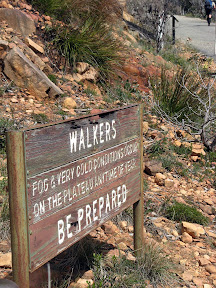
The climb up to Mt Difficult from Troopers Creek is a tough one, but rewarding. The loop around to Briggs Bluff via Long Point is also beautiful - all a very rewarding walk.

Grampians National Park


The 470m climb up to Mt Difficult, is, um, difficult. The trail follows follows the cliff face up. I guess it is a long, steep climb, which is where the difficulty comes in.

We hiked the circuit out to Long Point and around to Briggs Bluff, then back to Mt Difficult, in one day. It was a long weekend, there were many people out, some doing day walks, others camping overnight.


View in full screen format
Download GPX file - for use as a navigational aid in a GPS unit
Download KML file - view in Google Earth


Stats

Grampians National Park
Sunday Monday
03/10/2010 04/10/2010
Troopers Creek to Mt Difficult via Long Point and Briggs Bluff Mt Difficult to Troopers Creek
Distance 19.2km 3.8km
Start Time 7.38am 6.52am
End Time 4.33pm 8.26am
Overall Average 2.0km/h 2.0km/h
Oodometer 19.2km 23.0km

Saturday, October 2, 2010

Grampians - Mt Stapylton and Mt Zero

A day walk up to the summit of Mt Stapylton and over to Mt Zero.

Grampians National Park


The track ends just below the summit of Mt Stapylton.

We followed up the day hike by a two day hike up to Mt Difficult and Briggs Bluff.


View in full screen format
Download GPX file - for use as a navigational aid in a GPS unit
Download KML file - view in Google Earth


Stats

Grampians National Park
Saturday
02/10/2010
Mt Stapylton and Mt Zero circuit from Mt Stapylton campground
Distance 16.8km
Start Time 7.14am
End Time 1.29pm
Overall Average 3.0km/h

Monday, October 6, 2008

On its best behavior

Walkers: fog and very cold conditions occur on the plateau anytime of year. Be prepared.

ABW Grampians trip - Major Mitchell Plateau

Translation, cos really, I've never seen a sign like this before whilst hiking, basically Plateau Subject to Alpine Conditions. Really? Yup. An unprotected windswept high plateau can be pretty bloody cold. But, Major Mitchell Plateau was on it's best behavior. Sunny days which seemed warm, despite the vapour coming from our mouths (turned out it was 9 degrees on Saturday during our plateau ascent). Simon declared it was the coldest he had ever slept (that's a big call for him), turned out it was 0.2 degrees overnight, one of his water bottles froze. But there was no wind, so really, the weather was perfect, indeed on our descent it turned windier (very very cold wind) and Monday morning it rained, as we were on the bus leaving the Grampians the plateau was shrouded in dense fog.

Amazing views. Excellent camping, so weird to camp next to flowing creeks. So much water. The Grampians and me are gonna make good friends.


Stats:
Saturday
  • Distance: 13.2km
  • Start time: 8.42am
  • End time: 3.52pm
  • Moving duration: 4h 12m
  • Stationary duration: 3h 04m
  • Moving average: 3.1km/h
  • Overall average: 1.8km/h
  • Max speed: 10.9km/h
Sunday
  • Distance: 14.6km
  • Start time: 8.59am
  • End time: 4.23pm
  • Moving duration: 4h 29m
  • Stationary duration: 2h 47m
  • Moving average: 3.2km/h
  • Overall average: 2.0km/h
  • Max speed: 7.2km/h