It was Jude who gave us the tip. Butlers Beach. A privately owned campsite offering bush camping along 7km of spectacular coastline.
Hillocks Drive bush camping, Yorke Peninsula, Australia Day
Friday 23 January to Monday 26 January 2009
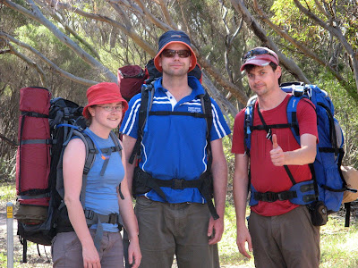
Alex, Bec and myself
Friday 23 January to Monday 26 January 2009
Alex, Bec and myself
 After some google efforts we had it tracked down, Hillock Drive at Butlers Beach. We drove down after work on Friday night, Alex bought me tea to make up for the $9 I wasted on parking my car in the multi-level next to work to save time, I had return home to get something he couldn't bring from his camping list.
Having found the key that was left out for us, we explored what campsites we could easily see in the 10 o'clock darkness. We shortlisted, and settled on one behind a huge sand dune with small trees sheltering and shading the site. It was a winner. The next day when we spoke to the woman in the shop to pay our camp fees, she declared it was probably one of the best campsites. Yeah! And it was, lots of shade,
plenty of shelter from the wind.
On Saturday morning we explored and walked through the sand dunes down to the beach. It ended up being quite a walk as we tried to make a path through the dunes. Eventually, having given up on following others' footsteps, we found Salmon Beach. We had camped behind a headland, so from what we could see there was no easy route to the beach. The water was wild, but warm, so we decided to strip down to our underwear and go for a swim. It was really really good. Bec decided not to join us, but filmed us, then wandered off for a walk as we dried off.
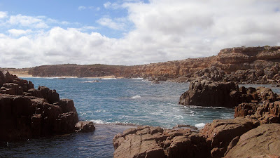
 Saturday afternoon we explored the coastline of Hillocks, there were a number of really cool beaches. We drove all the way to the end, only to discover later that beyond Gartrells Rocks it was 4WD only, yeah sure, it had been sandy and a challenge to drive through, but really, it was a private road. At Flat Rocks we discovered a series of shallow warm rockpools, and as we stood near the sea edge we were soaked by the extensive spray from crashing enormous waves.
Sunday we headed over to Edithburgh, going via a wind farm to see how huge those beasts really are. We found a sweet spot near Edithburgh that Alex had snorkelled at during a recent Easter family camping trip. It was low tide though, so we snorkelled under the Edithburgh jetty which was good. A cool breeze and deeper water meant the wetties were welcome. Some stuff to see, and other snorkelers too. Once we were out though, we saw a huge manta ray over a metre wide, if not one and a half metres wide.
 After a woeful lunch in Edithburgh, we drove to Point Gilbert near Port Moorowie, which was very seaweedy. We had a discussion about the name Periwinkle Reef, Alex argued it was mentioned in the SA Tourism guide, a reckoned it wasn't. A bet was made, an Ice Coffee in it. I won, claiming my prize on Monday in Moonta.
With all the seaweed and yellow water, we decided to check out the third spot mentioned in the guide, Parsons Beach, north of Hardwicke Bay. Nope, looked the same. With all this dirt road driving, we had been around for long enough for the tide to change, so back to our initial spot that was no longer just ankle deep. Saw little, and it was cool, except one small and remarkably stationary ray thing, and
Alex allegedly saw a Guitar Shark.
 After our swim Monday morning, we made pancakes, of which predictably the first didn't work, then packed up before heading out at 12noon to drive listening to the Hottest 100 up to Moonta Bay where we swam. The days had got hotter over the weekend, now for Aussie Day it was 35 degrees. Lots of people at Moonta Bay, a shallow but warm sea, in which the three of us played frisbee. Upon returning to our bag and towel, which we had left at a safe distance from the water's edge, or so we thought, they were about to be inundated. Listening to the countdown to 1 on the Hottest 100 we arrived back home at 6pm.
A top weekend, pity Jude couldn't make it down as she got into her Groupie thing for Tour Down Under, but still a fab weekend. Not enough photos perhaps, but that was cos so much of the stuff we did was in the water, so not a bad weekend at all.