Showing posts with label Trailblazer Challenge. Show all posts

Saturday, October 18, 2008

Trailblazer 2008

10:59 we named our team, that being our goal to do the 50km event in that time. We almost did, but easily made it in before sunset - 11h39m.

The Trailblazer Challenge
50km: Adelaide Oval to Mt Lofty summit


Like last year, it was hot, about 33 degrees. But this year, it was a generally overcast day, so that made it feel a lot cooler. After a good start at the starting archway - due to the congestion we walked around it rather than through it thereby giving ourselves a good headstart - we made good progress along the first 18km to Athelstone.

On the next stage to Morialta, Tim and I discovered just how much fitter we were than this time last year, we hiked from Gorge Road up Ambers Gully up to the fire track (from which you can see Black Hill) without stopping once. Woah dude. Felt good.

The stage through Horsnell Gully up to the radio tower checkpoint was as tough and unrelenting as last time, not because it is particularly steep but because it just goes on fooorever. From the radio tower checkpoint to Mt Lofty summit is always a pleasant walk, the sun was getting lower and filtered through the tall forest trees creating a spectacular sight, whilst being a shady walk.

Kudos to Kate for picking us up at Mt Lofty, armed with a selection of cold beers. Sweet as.


Saturday, October 20, 2007

Trailblazer

I can't understand why we struggled through the last sections from Morialta, other teams did too. Oh yeah, we'd been hiking for the past 11 hours.

The Trailblazer Challenge
50km: Adelaide Oval to Mt Lofty summit


So I wouldn't say it was easy, but it certainly wasn't as difficult as I thought it would be. I got no blisters, and only a very minor but manageable - thanks to Jenny's fantastic Black Diamond trekking pole - knee injury.

Likewise, other team members did well. One of our members deserves the 'best on ground' award for continuing on the course after throwing up bile after Morialta. Determined to finish, they kept up their fluids, and with some good rests along the way we all managed to complete the event together at Mt Lofty summit.

We met at the start point at Pinky Flat, near Adelaide Oval/Next Gen on the banks of the River Torrens. As Tim and I waited for the girls arrive, we got to see all the serious joggers psyche up for their events (There were 4 options available: 18km, 34km, 50km or 100km). Think ridiculously short shorts, and tubs of Vaseline being shamelessly applied. Not a pretty sight.


Myself, Tim, Coleen and Jenny at the start point beside the River Torrens

The first 18km to Athelstone follows Linear Park along the River Torrens to the hills. It was a 3 hour walk, following the bitumen pathways, so it can be hard on the feet, but we were 'in the zone' so it was all good. The free Red Bull, fruit and water top-up was a welcome sight at Athelstone. John, Jenny's partner, soon turned up with an esky and made us some fresh rolls - yummo.

It was about 10.45am when we left, hiking up what I consider the hardest hill on the trail. Or what I did consider the hardest, little did I know, our training preparation had led us the wrong way through Morialta, so the Trailblazer challenge still had a surprise in store for us. Regardless, this hill out from Athelstone, Ambers Gully, is steep and hot in the full sun.

By 2pm, when we reached Morialta, officially the 34km mark, it was quite hot. Ok, 33 degrees might not normally be considered hot, but it certainly makes hiking up hills in the sun a lot tougher. There's good reason why the hiking season is considered to be from April to October and not over summer. We ate some lunch in the hot shade and saw plenty of 50km participants withdrawing, the heat or the hike proving too much for them. Leaving Morialta we soon came across the little surprise that was awaiting us. An incredibly steep hill that I have little or no recollection of ever seeing before. It was also here where things took a turn for the worse for one team member.

Deciding to stick true to the course, we set up the next ridiculous hill, a recent re-route due to flood damage along the creek between the second and third falls. We saw plenty of participants head off along the closed, but considerably easier, section.

Hiking out of Morialta, we came across a ute with some eskies in the back - a support crew waiting for their team. Oh, how could they? What I would have done for a nice cold drink! Thankfully, one of them offered us some ice - they must have seen our expressions I'm sure. I'm no ice eater normally, but this was just heaven munching on ice.

Hiking through Horsnell Gully was a relief, the hot sun was now behind trees and the cool tracks and pathways were a welcome relief. The koalas were up to their normal antics, I love this place. Hiking out of Horsnell Gully, our last major hill aside from the last 650m to Mt Lofty summit, we were treated to some spectacular colours from the setting sun, the orange light lighting the pine trees in a magical way.

John was a very welcome sight at Checkpoint 3, at a radar station on a dirt road near Summertown. Tim and I got stuck into our freshly made wraps and a nice cold Pepsi Max, I'm sure I've never eaten a better wrap before. In a moment of sadism, the event organisers had chosen to place the checkpoint tent at the top of the hill where the radar tower stood, rather than down beside the roadway. We checked in and asked about medical help for our worsening bile-throwing-up member. No help or advise was available, but whilst we sat and ate we asked everyone who walked by if they were a paramedic. A seemingly random question, but the volunteers had told us a paramedic was hiking in a team of 3, apparently coming along soon. When he came, he admitted he didn't really care, he was too exhausted, but if one didn't actually feel too sick, they could continue, it was only the body saying it wasn't coping with the heat. It was only 5-7km left to the end, and it was dark now, so with no persuasion our sick member decided to continue.

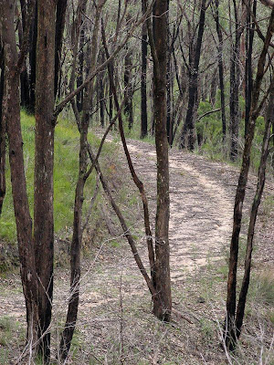
Head torches on, we hiked through the cool of the forests of Cleland, along the winding fire tracks that follow the contours of the hill. Easy hiking, and with a bright moon overhead much more pleasurable with the head torch turned off.

Just after 9pm we stumbled out of the bush onto the paved area that the white obelisk and cafe sit on at the summit of Mt Lofty.


Saturday, October 13, 2007

Trailblazer Training

33.3km. The most I have ever hiked in a single day. Not bad, in preparation for next weekend's 50km Trailblazer hike.

Ambers Gully, Athelstone, to Mt Lofty Summit


Just one week until the big event, the 50km Trailblazer hike (a fundraising challenge). We haven't done a lot of specific training for it, so Tim and I thought we would make this one last opportunity. I've been doing lots of regular hiking, and been swimming twice a week, but today we set out to do the entire 33.3km section in the hills. Next weekend, we do the same, but start 18km earlier at from Adelaide Oval, following Linear Park to Athelstone, before doing what we hiked today.

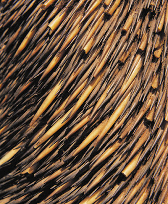
Pretty stoked that we saw an echidna in the Montacute Conservation Park, it was wandering along until it saw us and did the whole camo thing.


No, I didn't take this detail-photo of an echidna. No photos today.

It was tough, but we set a mean pace from the start. We had set out at 12 noon, we knew it was likely we would finish in the dark, but Tim had a prior engagement. I think I can safely say I have never hiked this fast before, after 4 hours of hiking we had only spent 21 minutes of that time resting. After 40 minutes for lunch at Norton Summit, yes it was 4pm by then, we had completed 19 of the anticipated 32km. Neither of us really felt any sorer after this point, although my knee started giving me grief in the last 5km (the next day though... woah, pretty sore hey).

We stayed true to the Trailblazer course, although because I had forgotten to bring the maps we strayed a little in Morialta. At Deep View Lookout we should have gone down to the carpark, then along the valley floor, whilst instead we maintained the same altitude and skirted around the edge. We didn't avoid the killer hill neither of us expected though, presumably a necessary re-route to avoid the bridge-less closed section of the Yurrebilla Trail.

Only during the last few kilometres did we put our head torches on, and the floodlit obelisk at the summit of Mt Lofty kept us going to the end. A nice look at the view was brought to a premature end as we started getting pretty cold. Wedges with a nice serving of sour cream and sweet chilli sauce worked a treat though in the cafe while we waited for Kate to come collect us.


Stats:
  • Distance: 33.3km
  • Start time: 12noon
  • End time: 7.20pm
  • Moving duration: 6h 10m
  • Stationary duration: 1h 09m
  • Moving average: 5.5km/h
  • Overall average: 4.5km/h

Saturday, August 25, 2007

Trailblazer Training

Our first official training hike for October's Trailblazer Challenge - 50km from the River Torrens in the city to Mt Lofty Summit. Today we tried out the first half of the challenge, Pinky Flat to Montacute Road.


We set out from Pinky Flat, Coleen's car safely parked behind a large tree, obscuring it from potential golf ball misdemeanors from the adjacent golf course. Although, now that I think about it, the North Adelaide golf course is quite a good one, I can't imagine too many newbies being able to get out onto this course on a Saturday.

We hiked the 18km to the entrance of Ambers Gully, along the River Torrens Linear Park. Easy walking, all on bitumen walking/cycling paths. Gotta watch out for those lycra-clad cyclists though, they seemed to be under the impression it is a veloway. Coleen was correct in surmising they should have signs up at all the track entrances - 'No lycra-clad cyclists (please use your nearest raceway). Other cyclists and walkers welcome'. Being bitumen walking though, it is hard on our feet. Something I think Coleen felt the most, having decided to wear her hiking boots, whilst Jenny, Tim and myself had opted for shoes. It took us 3.5 hours, we did it without a break, so that's about 5km/h. Lots of people out walking and playing with their kids, even one industrious mother with the child on the back of her bike and the dog on a lead off her handlebars. Not so many people though as we pressed on further towards the hills. Tim was impressed by what he saw, never having been this far up the park before, I can agree, very nice area, lots of hills and views and parks.

After a half hour lunch, which was perhaps poorly timed, as we immediately hiked up the steep 1.5km section up Ambers Gully. It was on this incline that Kate shared her distress during a recent hike, and I did not share my distress. But this time, whoa, it was tough and hot in the sun (forecast about 26 degrees), I felt a bit sick, but we had climbed hard and fast. After the climb it was an easy walk across the top of Black Hill, and back down to Montacute Road. I think we finished at 3 (?), so this 6km section had taken us about 1.5-2 hours.

The section from Ambers Gully to Montacute Road is 6km, bringing our hike to a total of 24km. All of us could have hiked more. With our busy schedules in the next few weeks, we made tentative plans to hike the second 26km section from Montacute Road, through Morialta, Norton Summit and Horsnell Gully up to Mt Lofty Summit.

No google map for today, you can check out the map Start - CP1 and Start - CP1 on the Trailblazer Challenge website. I have also recently purchased a GPS unit on ebay, but it hadn't been delivered yet, but should make calculating walk times, speeds, distances and maps easy.

Sunday, July 29, 2007

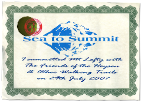
Sea to Summit

This 31km hike was in honour of the late George Driscoll, author of this particular Sea to Summit route, as published in the "50 Real Bushwalks Around Adelaide".

Brighton Beach to Mt Lofty Summit


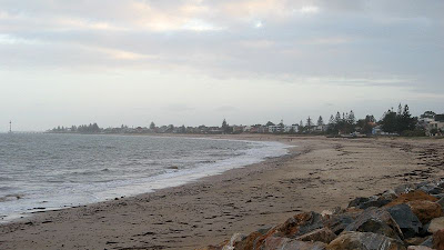
This hike took 9 hours I think, from 8am to 5pm, and was a hike organised by The Friends of the Heysen Trail. We met at the kiosk next to the caravan park at Brighton, dividing into two groups, one group to hike the whole way today, and a second group to finish at Belair and complete the rest of the hike next week.


With the 27 people hiking the whole trail we set off, hiking through a mixture of conservation parks, national parks, fire trails, reserves, walking paths and roads. We set a good, fast pace to ensure we made it to Mt Lofty Summit before sunset. It was steep early on, then again through Belair National Park, but generally, despite the overall 727 metre altitude climb it wasn't particularly steep. Following the railway line from Shepherds Hill to Belair National Park was quite flatish, as was sections of the Crafers to the summit.

Hiking beyond the freeway exit at Crafers was my favourite section, following little used fire tracks and trails through the bush. It was a little eerie as the temperature dropped and the fog came in. The morning had been a little drizzly, and through Belair National Park and these trails near the summit their was lots of water around, so all our shoes got a good soaking. When we reached the summit it was eight degrees (having been 17 degrees earlier), but strangely it didn't feel too cold given the tough hike we had just completed.


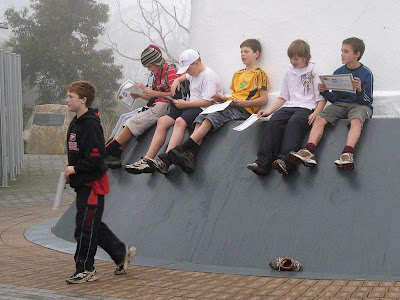
Graham brought five of his Year 6/7 students along, they had done some training hikes, and were just bundles of energy leading the pack. They quietened down a few times, but were quickly revived with food. We had lunch at Belair National Park, Trevor and another cooked us up some sausages (not recommended for hiking tho!).


During the group hysteria of having completed the 31km hike, I agreed to do the 50km hike of October's Trailblazer with Coleen and Jenny. Some fervorous sms'ing also had Tim in too, so the four of us have teamed up for it. The Trailblazer is a fund raising hike, from Adelaide Oval to Kuipto, with various endurance distances available, I think 18km (end of Linear Park), 50km (Mt Lofty Summit) and 100km (Kuipto Forest). You have 24 hours to complete the event in your team, and they have support stuff along the way. 50km can't be that much tougher than 31km... surely? Btw I had never hiked 31km before in one day, I think 25km was my previous record.


50 Real Bushwalks Around Adelaide
2004, Scout Outdoor Centre,
ISBN 0 64630 510 7
View Trail Notes


Map from the book


View map in full screen mode