I rode three days along WA's renowned Munda Biddi Trail. No, not really, much of it I had to push my bike.
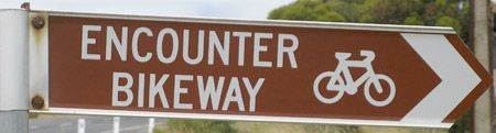
Munda Biddi Trail
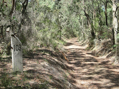
 The Munda Biddi Trail stretches from Mundaring in the north, in the Perth Hills, down to Collie and Nannup. Some 500 kilometres south, it is planned that the trail will reach the 800 kilometres to Albany sometime next year. I chose to ride four days from the northern trailhead at Mundaring. Wrong choice.
The riding was tough, this was immediately clear on the day I set out. Within the first two kilometres I fell off my bike twice. What was to become a familiar pattern, the rutted gravelled track was no friend of the bike trailer, or for that matter a bike with panniers.
I had planned to ride from the northern trailhead, itself in the town of Mundaring, but due to the lack of accommodation options (the caravan park was a no-show) I drove some seven kilometres down the trail to Mundaring Weir, staying the Perth Hills YHA. Here I could safely leave my car, and would be able to catch two trains and a bus back to Mundaring, but would have to walk the seven kilometres down the Trail back to the YHA, there being no public transport to the weir, despite the parks and picnic areas.
I discovered later from others that the section from Mundaring to the first campsite, Carinyah, is notoriously difficult. Indeed, this whole section from Mundaring to Dwellingup is glorious, but tough. I really should have done more (or for that matter, some) research. A guy with a similar bike trailer rode from Mundaring to Collie in 13 days, although he was ill-prepared and carrying too much weight.
The first 12 kilometres of the first day took me over two and half hours, plus the time it took me to replace a blown tyre and repair a puncture. Thank you to Graham for giving me that habit of carrying a spare tyre, my tyre was unrepairable! This section was labelled as challenging, indeed it was a ripper. It was very difficult to push the bike and trailer along, riding was out of the question. Even pushing the bike my feet would slip on the narrow, gravelled, rutted path. Only two or three kilometres into the Challenging section I came across an alternative route option for touring bikes. There was no question in my mind as to what route I would be taking!
From here on whenever I came upon a section labelled challenging, I would seek out the alternative touring route, or where none was available, seek out dirt roads that I could get around the area. It was very well worth it, as proven on the third day's ride when I rode a section labelled challenging, but this time without the trailer, and with two boys instead. It was hard work to push the bike up those river valley sides, it would have been impossible to push the bike and loaded trailer.
I met and rode with some great people along the trail. On the first day I didn't meet anyone, and camped alone at Carinyah campsite. Carinyah in the local indigenous language means Happy Home and indeed it was a fanastic campsite. A very spacious hut with park benches, sleeping platforms, bike racks and even a bike fixing rack. Very nice! I wish the Department for Environment and Heritage in South Australia would take note and build similar standard huts, the Bibbilmun Track huts were of a similar high standard. It was easily the coldest night - a mere 3 degrees - I have spent in Western Australia, even colder than the night spent on the Nullabor.
On the second day I met Reg, as I was parking the bike for a moment's rest, he rode up behind me. We discussed bikes and plans for the day, he was impressed with my bike trailer and wondered how it performed. He followed me up a hill to witness it's performance. With a trailer one is forced to travel slow uphill - it's hard work - and going slow downhill is advised. With a rutted, gravelled track one wrong move and the trailer could bounce into the rut, bringing the bike and you into the rut with it, and most likely you off the bike. At the top of the hill, he took off past me down a ridiculous hill at an adventurous speed. Indeed, this trailer was certainly slowing me down. At the bottom of the hill though Reg was nursing his bike, he had just broken a wheel spoke on the downhill run.
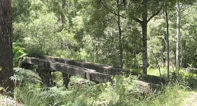
We lunched at Wungong campsite together. Another excellent campsite, but I was there by 12.30pm and Jarrahdale was only 26 kilometres away, the section of track being labelled as easy. We rode into town together, some of the ride following an old logging railway. The ride was indeed very easy, it would have been interesting to have noted the different average speed for this after lunch section compared to the morning's section, I think it would have been vastly different.
Reg assured me he had heard of cyclists staying at affordable accommodation in town, and although a free campsite was my preference, dividing the track up in this way made much more sense. At the General Store and Cafe I asked about nearby hostels and campgrounds, there are none I was told. Well shit me. I sauntered off down the pub to ask there, and they told me of an option just out of town. I returned to the Store to tell Reg and grab my bike. He had been busy on this iPhone looking up options, probably concerned about him misleading me. An assistant at the Store overheard our conversation and returned with a leaflet with many options, but mostly B&Bs. Too expensive for me, no worries though she said, you could stay next door. It is set up like a hostel, only $30 a night, we administer the bookings. What! This is perfect, why did the other girl tell me there was nothing around here! The community run hostel is in the former Nurses Home for the now demolished hospital. Called the Environment Centre, it is also a community centre of sorts. The facilities are excellent, good beds, hot showers, fully stocked kitchen and heating! Perfect for passing cyclists, if you want to use it remember to insist it exists if you are told at the General Store and Cafe that there is nothing around here!
On the third day I saw a mother with a couple of kids riding. The husband, Nick, was meeting them with the car at regular intervals, and at once such interval I stayed to share some lunch - such a great lunch spot it was. Jane was riding with her two boys, Cameron (11ish) and Lachlan (9ish) to North Dandalup Reservoir today, this would complete their ride from the trailhead and Mundaring to Collie, some 300 kilometres to the south. They had originally set out during school holidays to ride the whole distance, with home-made panniers and their camping gear but the weather got the better of them after eight days on the track. They planned to continue their ride over coming weekends, completing the trail south of Collie down to the present southern trailhead at Nannup. They had previously completed walking the 1,000 kilometre Bibblimun Track, and are hoping to publish a children's book later this year.
I took up Nick's offer to put the bike trailer in the car trailer, and ride with Jane, Cameron and Lachlan to the dam. Oh my goodness, it was glorious indeed riding trailerless - it's like moonwalking. Jane soon recognised her boys had met a match, and took a ride in the car, leaving me to ride with the two boys along a section labelled challenging to the reservoir. The boys make an excellent team, looking out for each other and planning not one step but two steps ahead with their map reading.
At the reservoir I took up Nick and Jane's offer to drop me in town down on the plains. I had already decided that morning that I would camp just past the reservoir at the Dandalup Campsite, and get up at 5am the next morning and ride downhill, out of the ranges to meet the 7am train to Perth. My knees were sore and would only get worse, I don't think I had another day in me.
At the Pinjarra Caravan Park I booked my train ticket for the following morning. I had always intended to finish here, but after riding a fourth day to Dwellingup and then down from the range to this plains town.
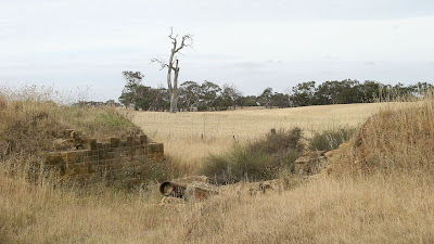
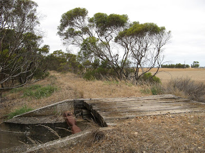
Sorry, not many photos this time, cycling a hard trail and caring to take photos at the same time was too much. Anyone who has cycled before will know that photography and cycling arent a good mix anyway.
Download Google Earth KML file of the first three days south from the northern trailhead of the Munda Biddi Trail |
Download kml file to view in Google Earth or adapt to use as a navigational aid in a GPS unit |
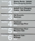
| Stats | Munda Biddi Trail (Mundaring to Dandalup) | |||
| Friday | Saturday | Sunday | Monday | |
| 28/5/2010 | 29/5/2010 | 30/5/2010 | 31/5/2010 | |
| Mundaring Weir (YHA) to Carinyah campsite | Carinyah campsite TOI Jarrahvale | Jarrahvale to North Dandulup Reservoir | Mundaring to Mundaring Weir (YHA) | |
| Distance | 32.7km | 59.0km | 29.1km | 7.5km |
| Start Time | 9.30am | 8.15am | 8.15am | - |
| End Time | 4.00pm | 3.45pm | 2.00pm | - |
| Moving Duration | 3h58m | 5h29m | 3h33m | - |
| Stationary Duration | 2h35m | 1h58m | 2h15m | - |
| Moving Average | 8.2km/h | 10.8km/h | 8.2km/h | - |
| Overall Average | 5.0km/h | 7.9km/h | 5.0km/h | - |
| Oodometer | 32.7km | 91.8km | 121km | 128km |


 March 29, I just discovered