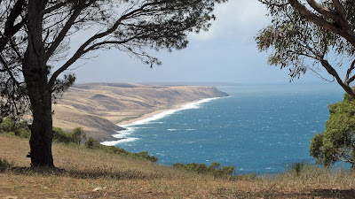
So said Kate as we discussed the way our heavy packs increased our chances of falling down the steep sides of the trail through Deep Creek. She was carrying all the snacks, including the lollies and chocolate, so, in her words, at least she would die happy if she fell.
Hiking the Heysen Trail along the South Coast
This was our first serious pack-carrying hiking together. I had done some before, and the three of us had done some in Innes National Park last October.
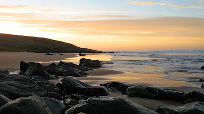
We spent 4 days hiking, and camped out 3 nights. The first night we spent with many others (including a witch coven by the sounds of some of the laughs) in the overflow area of Trig Campground. The second night was impressive, we camped in a Heysen Trail camp site at the end of the 5km Tunkalilla Beach. It was pretty nice to have the site and beach to ourselves, long away from the reach of roads. However the third nice was the best - sweet - at an unnamed beach between Coolawang Beach and Parsons Beach. It was very cool, a nice short beach with rocks at each end and a dry creekbed entering the sea. It was here in the grassy creekbed we set up camp. Of course, if this were the outback that would have been incredibly stupid, but on the coast we would notice if rain came (no risk of flash flooding). This was a beautiful beach for a swim in the cool waters and big waves, we were only interuppted by a local farmer boy who drove his ute across the paddocks to go for a surf on his own private beach.
It took us a little longer than expected to get organised, so instead of setting out at 3pm for our estimated 3 hour first-day hike, we set out at 4.30pm. Lucky it was still daylight saving and sunset was at 7.30pm. It was only 7.5km, but it involved a going down into and up out of a deep valley. It was here, deep in the bush that we discovered how overgrown the track was, but also how much harder it was to negotiate with a full pack.
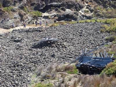
Saturday was our longest day - 16km, although 5 of those kilometres was along Tunkalilla Beach. We tried following a fence along the top of the dunes to avoid the soft sand, but it got too tough so we ended up back on the beach. The soft sand was hard work with heavy packs. Earlier in the day at Boat Harbor Beach we came across a group of guys who had set up a mini-golf hole with drift wood and flotsam. Wow I got to use the word flotsam. Today we also hiked through Deep Creek itself, unfortunately unlike when I was here last in December, the waterfall wasn't flowing this time. We did however appreciate the efforts of the Australian Conservation Volunteers who had cleared back vegetation along a couple of kilometres of track - it made hiking with pack much more enjoyable.
We finished on Monday by lunch-time, we had set out early after a spectacular sunrise and swim to finish the last 5km to Parsons Beach and Waitpinga Beach and the car.
Because the last two of the three nights had no water, the first campsite being nothing but a clearing, and the second campsite not being an official campsite, we had left twelve litres of water at a campsite called Balquihidder West, which we collected on Sunday morning. We learnt some cool stuff though, good preparation for our December trip to Tasmania.
View photos as full screen slideshow
Stats:
Friday 21 March: Cobbler Hill to Trig campsite
- Distance: 7.5km
- Oodometer: 7.5km
- Start time: 4.39pm
- End time: 7.26pm
- Moving duration: 2h 03m
- Stationary duration: 34m
- Moving average: 3.7km/h
- Overall average: 2.9km/h
- Max speed: 6.9km/h
- Distance: 16.3km
- Oodometer: 23.9km
- Start time: 10.00am
- End time: 5.22pm
- Moving duration: 4h 33m
- Stationary duration: 2h 44m
- Moving average: 3.6km/h
- Overall average: 2.2km/h
- Max speed: 7.8km/h
- Distance: 12.4km
- Oodometer: 36.3km
- Start time: 10.33am
- End time: 3.46pm
- Moving duration: 3h 06m
- Stationary duration: 2h 06m
- Moving average: 4.0km/h
- Overall average: 2.4km/h
- Max speed: 6.5km/h
- Distance: 5.9km
- Oodometer: 42.2km
- Start time: 8.48am
- End time: 10.46am
- Moving duration: 1h 25m
- Stationary duration: 20m
- Moving average: 4.1km/h
- Overall average: 3.3km/h
- Max speed: 10.3km/h