A trial hike with our overnight packs - a first for Kate & Tim - in Innes National Park. Should have packed the chocolate, and another book.
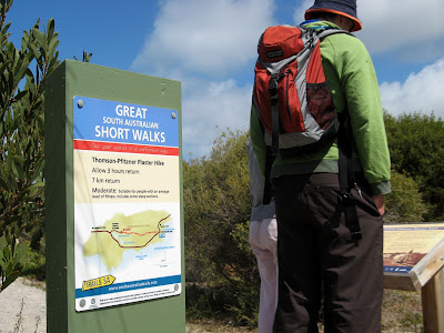
A day hike on the Thomson-Pfitzner Plaster Trail Hike
and an overnight hike along the Gym Beach Hike
and an overnight hike along the Gym Beach Hike
We left our car and big tent set up at Browns Beach, setting out on the 6-hour return (or 4-hour return depending on the sign or publication you read - it's 4-hours according to the park ranger) hike from near Browns Beach to Gym Beach. Only 5.5km, it took us 1h 06m to get there, and the following day 1h 09m to return. Our hike was 6km each way, a bloody easy hike, but fair go it was Kate & Tim's first pack hike. We could have hiked back along coast, over two headlands and Browns Beach, but we returned the way we came (hiking on sand with full packs can be hard!).
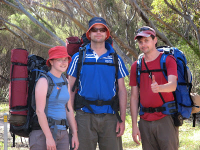
It wasn't particularly interesting, but then not much of Innes National Park is really that interesting for hiking. If you like bird-watching - perfect, that's what the park was created for, some bird that was believed extinct and discovered here in the 1960's. The hike was hot, with little shade, but what shade there was felt very cool. Gym Beach campsite was good, we set up camp on a site with close beach access, and near the nice non-smelly modern toilets with a rainwater tank. Better than our tent site was at Browns Beach - smelly, no STINKY, toilet, no rainwater, no shade, no separate tent sites, no close beach access, and no tree branch intent on scratching us all at least twice. Great if you love fishing though... wish I did :-/ No shade at Gyms Beach Campsite either, and a park table and bench like those in Lincoln NP wouldn't go astray, especially for hikers, but it was much better. Good beach, we sat upon some rocks as the waves crashed around us, watching the sun set and reading our books. Good fishing, and probably swimming and body surfing too. Funny how everyone empties off the beach for sunset, the best part of the beach day I think.

Should have packed chocolate, and another book. I finished reading my book too early... and Tim and Kate hadn't finished theirs yet, so we couldn't swap. After tea, Tim and I tried to find the Southern Cross in the night sky. I found the most convincing cross, then used the method in the "Dangerous Book for Boys" to find south... except it pointed in the direction where the sun set. Tim, using the sunset as a guide, found south, then determined to find the best cross to fit his 'south'. I don't think either of us actually found the 'Southern Cross'... but south we found.

On the Saturday - we arrived Friday night - we hiked the Thomson-Pfitzner Plaster Trail from Stenhouse Bay to Inneston, following an old railway alignment which transported gypsum from the mine at Inneston to the jetty at Stenhouse Bay. Not greatly interesting either. Followed a spur trail on the way there, which follows the contours of the land, this railway alignment being built later for steam locomotives (rather than the earlier horse-drawn trains). Inneston, a town built in the 1930's and abandoned in the 1970's, is little but ruins and some restored cottages, but quite interesting. Kate and Tim hadn't been to Innes before, but I had been here a couple of times before.
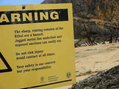
Also stopped by Ethel Beach, where the 1904 Ethel is wrecked on the beach, and the 1920's wreck of the Ferret lies off-shore.
A good weekend, we extended the long weekend by an extra day. It was Kate & Tim's first trip to Innes NP, my third I think. Pretty cool place, good fishing, surfing, camping and swimming. Swam at the rock pool on Shell Beach - was pretty cold. We were first there at high tide on Sunday, but watching the waves crash it we thought it might be too dangerous, as the waves sucked the water through the length of the rock pool. We returned Monday morning, having established when low tide was from my GPS unit's "Best fishing times" guide. We swam, well, Tim did, I just jumped in and got out I think - it was pretty cold. Afterwards, as we sat on the rocks in the sun, a huge voilent freak wave crashed through, much larger than the waves of the previous high-tide day, and washed right across the area we were sitting. Glad we weren't swimming at that time!
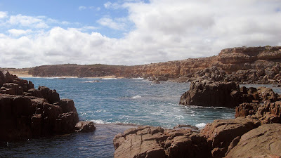
Missed a good hike opp though, Anne reckoned this was the pick of the Innes hikes - Royston Head. Saw a sign, planned to get there, but wasn't keen to go on a hike straight after our only weekend shower.
Royston Head Walk
4 km return, 2 hr return
Spectacular views of the rugged peninsula coast and blue ocean. There is a fantastic lookout point from the cliffs at Royston Head with a tranquil beach below.
Enjoyed the benefits of a long term investment. I think I was here last about 4 years ago, we had paid for shower tokens for Pondalowie, but some of them just gave us cold water. This time though, I don't know what we were thinking, we skipped the token purchase opting for cold shower by driving down to the Pondolowie campsite. After enduring a minute of cold water though, it was hot as, and without using a token! Yay!
View photos as full screen slideshow
Stats (Gyms Beach hike):
- Hike distance: 6.0km
- Trail distance: 5.5km
- Moving duration: 1h 09m
- Moving average: 5.2km/h

4 comments:
Hey Jez (if I can be so familiar)
Found your blog while looking for info on hiking. I've just finished a book on hiking the Camino de Santiago in Spain and feel all electric and inspired to begin my own pilgrimage of sorts. Of course hiking the 800-odd kilometer Camino without any prep seems a little keen - even for me and I'm the queen of keen.
Probably sensible to try something closer to home like the Heysen to start eh?!
Anyway, just wanted to say excellent blog, entertaining text and great photos. Keep it coming!
Tez
Gym Beach was cool, even if the hike was too short to write home about. Those massive camping mats look good too, makes your pack look like a mere daypack by comparison.
And I stand by my version on the Southern Cross! Until shown the real one, my only option is to bring a compass/gps/sense of direction then find the stars to fit.
Langtang Valley Trek 11 Days
Thanks for sharing this info you can also visit our site.
Langtang Valley Trek 11 Days
Post a Comment