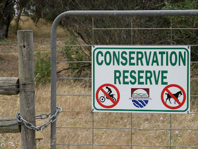
It was easy: 12km along the former railway from Sandergrove to Milang, beside Lake Alexandrina. A conservation reserve: no motorbikes, no horses, no dogs, oh, and no cyclists.
Well, not entirely true. There was no sign forbidding cyclists, but there were signs for the others, or it is just always the case in conservation areas. Cyclists were ok, I guess, however bear in mind that at every road crossing there are two fences to cross. There is a vehicle access gate - locked, so you have to carry your bike over the stile or throw your bike over the fence. I knew this though, I read about this rail trail on the Rail Trails website beforehand.
The railway was opened in 1884 as a branch line, and closed in 1970. The former railway was declared a conservation reserve in 1991, more information about the reserve can be found on the National Trust website.
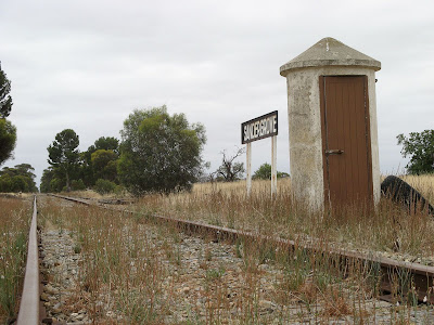
I parked near Sandergrove railway station, then headed back to the station - not that there is much more than a sign to see adjacent the Steamranger tourist railway from Mt Barker to Goolwa and Victor Harbor. From here, I traced the former railway to Tucker Road, where the Nurragi Conservation Reserve began.
From Tucker Road to Dry Plains Road the trail is tough. It is not well clearly defined - although the former railway is, the walking path is not. It is overgrown in this area, and I started to have second thoughts about my plans, but this is the most overgrown section, and a relatively short section too. Be careful of a former bridge, marked on the google map below (as in be careful of the bridge that isn't there - could give you some nasty scars).
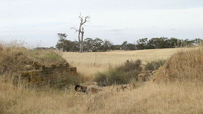
The stonework dates from the 1880's
From Dry Plains Road to the Finnis - Milang Road the path is much easier to ride or walk as it is a vehicle maintenance track. The only other bridge on the former railway, albeit smaller, has been remedied to allow vehicles to cross it.
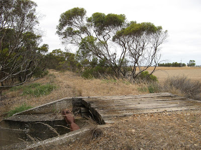
There is plenty of birdlife to be seen, and kangaroos, and I'm sure snakes too.
It's a surprise to come across the former Nurragi Railway Station - from where the conservation reserve takes its name.
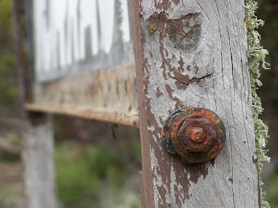
From an unnamed track crossing the trail, about half way between Nurragi Railway Station and the bitumen Finnis - Milang Road, to that bitumen road, the trail is quite overgrown. Returning on my ride from Milang, I chose to ride along the vehicle track which follows south-western fence.
From the bitumen road to the end of the conservation reserve the trail is a single width foot track. It is here, and back at Sandergrove Railway Station, where it is clear that motor bikes have been using the conservation reserve. Here too you can see evidence of horses and dogs (well, friendly people walking past with dogs).
The trail and conservation reserve ends at Landseer Road, on the outskirts of Milang. I think it would be quite possible to continue walking or riding along the former railway reserve straight into Milang - the land is still clearly fenced and looks to be used only for horse something or other. Whatever horses do. Eat grass I guess. The fact that the fencing remains on both sides would suggest it is still crown land and not private farmland. However, I was glad to ride faster and easier on a real road now.
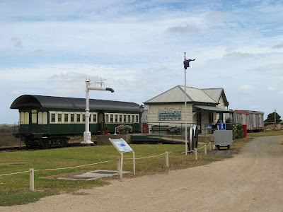
I rode onwards to Milang Railway Station. It's a cute timber building with some rollingstock beside it. The building was sold to a local farmer when the railway was closed, but was returned and restored in the 90s.
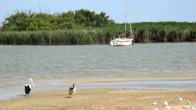
From here I rode the short distance down to the lakeside. Despite the drought, the lake still seems relatively high, although it is presumably at a level below sea level.
Riding back to my car was easier, I took some shortcuts which were longer but easier to ride. I also didn't suffer from the must-stop-and-take-a-photo-syndrome on the return journey. A good ride, very flat too.
This ride has nothing to do with the Mawson Trail, I know that. But I haven't been able to ride any of the Mawson Trail this year. Winter for me is hiking, and summer cycling, so I will post my future cycling adventures here. I stayed overnight in Goolwa after this ride, riding the Encounter Bikeway from Goolwa to Victor Harbor the following day. I will post up some photos and stuff for that one later this week.
View photos as full screen slideshow
Stats:
- Distance: 29.6km
- Start time: 1.35pm
- End time: 4.50pm
- Moving duration: 2h 22m
- Stationary duration: 45m
- Moving average: 12.4km/h
- Overall average: 9.4km/h
- Max speed: 29.3km/h

1 comment:
We Buy Vehicles’ cash for cars melbourne the only company within the market that provides free evaluation and comparison service, not in the slightest degree like a number of our purchaser in hand rivals we’re here to urge you the foremost for your vehicle.
Post a Comment