Sunday, August 19, 2007

Here's Hoping for Summer

Saturday was a clear, sunny day. Last weekend was hot. Obviously (?!), today would be likewise, so out with my really small backpack, shorts and a t-shirt. Not long until summer now, but was I getting ahead of myself?

The Lavender Federation Trail
Day 2: Monarto to Preamimma Mine


Well, it was, luckily, hot cos with my small backpack I hadn't packed anything much extra to keep warm, no rain stuff either. Everybody was rugged up when we met, ok, the morning was cold, but they all set out on the hike like it - jackets, beanies. And me? Shorts and t-shirt. Yes, it was cold in the shade, but not for long. Soon, everyone had those jackets, jumpers and beanies off, it was a clear, windless, sunny, warm day. Although someone did remind me it was, in fact, still winter, and not really that close to summer. But there was me longing for the hot summer days. Can I make summer come sooner by dressing summer-like? I think so (you may not).

Starting at the entrance to Monarto Zoological Park, we followed an old rusty railway. Yes, I've seen the Don't Play with Trains tv ads, clearly the railway could still be used, but it wasn't in too good a shape, so I walked along the tracks whilst the others walked along the track next to it.
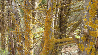


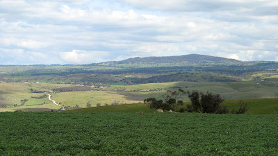
Surprisingly, there were lots of photo opportunities today as we walked along little-used dirt roads and across paddocks and along creeks. Good views from Highland Road in both directions - to Mt Barker and over to the River Murray.


We walked across a paddock, past a sign that left us in no doubt we were not to wander off the trail at all, and hiked past the remains of Preamimma Mine, complete with a chimney, ruined buildings and some tailings. But we couldn't have a closer look, which was disappointing. Looking in the Google Map (map view) below you can see that the trail at this point is following a public right-of-way, but as is often the case with these trails, no actual road. Bev said she had read somewhere that this chimney was somewhat unique because of it's square base. From a quick google search, the remains are considerable, and it was an arsenic mine in 1854, 1862 and finally in 1899.
Website: www.aussieheritage.com.au.


An easy walk, but surprisingly scenic. Looking forward to future hikes along the Lavender Federation Trail, the next scheduled one is October 21 (2007). Pity they aren't more regular, I heard murmurings that perhaps George would seek to schedule some extra ones in during November.


  • Distance: 15km
  • Duration: 4.5 hours (9.45am - 2.15pm)
  • Weather: 17 degrees, clear, sunny (hoping for summer!)

Sunday, July 29, 2007

Sea to Summit

This 31km hike was in honour of the late George Driscoll, author of this particular Sea to Summit route, as published in the "50 Real Bushwalks Around Adelaide".

Brighton Beach to Mt Lofty Summit


This hike took 9 hours I think, from 8am to 5pm, and was a hike organised by The Friends of the Heysen Trail. We met at the kiosk next to the caravan park at Brighton, dividing into two groups, one group to hike the whole way today, and a second group to finish at Belair and complete the rest of the hike next week.


With the 27 people hiking the whole trail we set off, hiking through a mixture of conservation parks, national parks, fire trails, reserves, walking paths and roads. We set a good, fast pace to ensure we made it to Mt Lofty Summit before sunset. It was steep early on, then again through Belair National Park, but generally, despite the overall 727 metre altitude climb it wasn't particularly steep. Following the railway line from Shepherds Hill to Belair National Park was quite flatish, as was sections of the Crafers to the summit.

Hiking beyond the freeway exit at Crafers was my favourite section, following little used fire tracks and trails through the bush. It was a little eerie as the temperature dropped and the fog came in. The morning had been a little drizzly, and through Belair National Park and these trails near the summit their was lots of water around, so all our shoes got a good soaking. When we reached the summit it was eight degrees (having been 17 degrees earlier), but strangely it didn't feel too cold given the tough hike we had just completed.


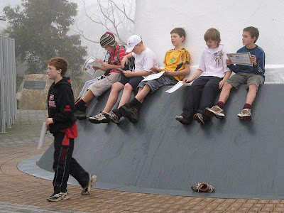
Graham brought five of his Year 6/7 students along, they had done some training hikes, and were just bundles of energy leading the pack. They quietened down a few times, but were quickly revived with food. We had lunch at Belair National Park, Trevor and another cooked us up some sausages (not recommended for hiking tho!).


During the group hysteria of having completed the 31km hike, I agreed to do the 50km hike of October's Trailblazer with Coleen and Jenny. Some fervorous sms'ing also had Tim in too, so the four of us have teamed up for it. The Trailblazer is a fund raising hike, from Adelaide Oval to Kuipto, with various endurance distances available, I think 18km (end of Linear Park), 50km (Mt Lofty Summit) and 100km (Kuipto Forest). You have 24 hours to complete the event in your team, and they have support stuff along the way. 50km can't be that much tougher than 31km... surely? Btw I had never hiked 31km before in one day, I think 25km was my previous record.


50 Real Bushwalks Around Adelaide
2004, Scout Outdoor Centre,
ISBN 0 64630 510 7
View Trail Notes


Map from the book


View map in full screen mode

Saturday, July 28, 2007

Tough hiking - but I didn't let on

I was accused of not letting on that I too, the well seasoned hiker, was finding this hike difficult. But that climb at the northern end of trail, along Ambers Gully, was bloody tough.

The Yurrebilla Trail
Section 5: River Torrens to Morialta
Section 4: Morialta to Norton Summit


We have had plans to hike the 54km Yurrebilla Trail for some time now, and our need to do some training hikes in preparation for doing the Overland Track in January 2009 (yes, 18 months away) was paramount (in the past 12 months, we'd only hiked in the Flinders for one weekend).

So we met in Norton Summit, leaving a car there before driving to the end of the trail, near Linear Park/River Torrens at Athelstone. The Yurrebilla Trail goes from Belair National Park to the River Torrens, some 54km divided into 5 sections. Today we hiked 2 sections, Section 5 and Section 4. Section 5 was listed as 'hard', 13km and 5 hours, and Section 4 was listed as 'moderate', 7.5km and 2.5 hours. The whole 19.5km we hiked took us 6 hours.

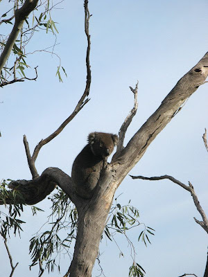
Ambers Gully was a delight (through Black Hill Conservation Park), albeit short lived perhaps as the steepness of the grade soon had us thinking second-thoughts. It was at this point, that perhaps, I should have let Tim and Kate know I too thought it was quite tough. Apparently Kate was too busy panting to notice me doing likewise. Tim and I heard what sounded like a wild pig, but turned out to be a koala. I'm not much of an animal spotter, and have never heard a koala in the wild before. I've only ever seen them all drugged up and sleeping. We hiked up to the summit of Black Hill, and down into the valley which Montacute Road passes. A steep climb down, I'm glad we hiked the direction we did than have to hike up this steep climb out from Montacute Road.


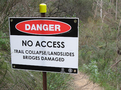
Following Montacute Road for a little less than a kilometre, we then hiked up into Montacute Conservation Park. There were a couple of tough sections. Tim grew increasingly quiet, so we fed him some Snickers and he pepped up. Entering Morialta Conservation Park, we ate lunch at the Deep View Lookout overlooking the fast flowing First Falls. A spectacular viewing platform, I was really impressed with hiking through Morialta Conservation Park. I had forgotten how good this place was. We hiked past the Second Falls and onto the Third Falls. It was here, we found a sign stating that the trail was closed due to washed out bridges and rock slides. We didn't know it at the time, but apparently it has been like this since at least August last year. We hiked on though, as we were committed with a car at each end of the hike.


Nearing Norton Summit, we took a short cut of about 150 metres, cutting out at least a kilometre of up and back. We saw the old barns, also part of the trail, from the road, and cut this section off too, saving perhaps another 300-400 metres. Arriving back at the car, we enjoyed some light snacks at the pub at Norton Summit.


The Old Barns which the Yurrebilla Trail officially passes through


Tuesday, July 17, 2007

Seven Minutes Past Monkey

The monkey laughed, Dan, or a leader-by-proxy, had pulled it's legs - it now squawked with laughter. It was the signal, time to move out - in seven minutes anyway.

Alligator Gorge to Mambray Creek

Monkey featured highly in Dan's leadership style. This little toy monkey, with it's elastic legs, woke people who overslept and signaled the time to move out.

It was my first overnight hike - well, since PE camp in Year 9 - and my first hike with the Adelaide Bushwalkers. I had only recently joined this hiking club, in order to experience some overnight hiking and camping out, and to meet some new people - hopefully people my own age (the cross section of ages in the hiking club Friends of the Heysen Trail is older).

Yes, there were younger people. It was good. I also enjoyed the relatively organic style in which everything was organised, being a smaller club it is not as organised as the Friends of the Heysen Trail. This is good, more of a grass-roots approach.

We were hiking in Mt Remarkable National Park, from Alligator Gorge to Mambray Creek. There were two overnight camps, and two days of hiking. With 17 hikers, we divided into two groups, one group spending Friday night camping in the north, at Longhill Camp near Alligator Gorge, and the other group camping in the south, at Mambray Creek.

I grabbed a lift with David, and Jeff and Karen. We parked our car, and in the dark hiked a few hundred metres down into the valley to our campsite. The forecast temperature was a mere four degrees, but it didn't feel that cold yet. We joined the others and set up our tents, people seemed impressed with my $70, 2.05kg hiking tent. Best value-for-money. The next morning we hiked north through Alligator Gorge, up past The Terraces and out of the gorge to The Battery. It was tough, but mostly due to the 16kg pack I was carrying. Even though I thought I had my waist belt tight, it wasn't until the following day, with my bruised shoulders, that David show me a few tricks to get it even tighter - so it would carry more load and be much more comfortable.


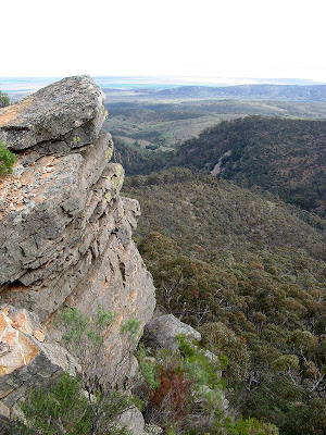
The views from The Battery were spectacular, much better than the views from The Bluff back on the Heysen Trail in the south. From our vantage on the spectacular escarpment, we could see to the head of Gulf St Vincent, to Port Augusta and Baxter Detention Centre, and across the gulf to Port Lowly. Wow. It was an awesome view.


We reached camp after climbing down the steady but long Fricks Track to Kingfisher Flat. We met the other group who had hiked up from Mambray Creek in the south. It was a cold night, no fires were allowed in the national park except in Mambray Creek. Unusual for a national park.

The next morning we parted ways again, hiking down to Mambray Creek via Hidden Gorge. We had swapped keys that morning, so we grabbed each others cars and rendezvous at the bakery at Stone Hut. The food and beer was to it's usual excellence (the Coopers Pale Ale was a little old though), and the staff were in their usual grumpy form (don't let that put you off - the food and atmosphere is fantastic).


View Google Map in full-screen mode

Tuesday, July 10, 2007

Introduction

I started getting into hiking back in 2006, and have been hiking the 1200km Heysen Trail from Cape Jervis to Parachilna Gorge in South Australia. I've been hiking a couple of weekends a month each year during April to October, I expect to complete the trail in August of 2008. All of my blog entries for this are located in a dedicated Heysen Trail blog.

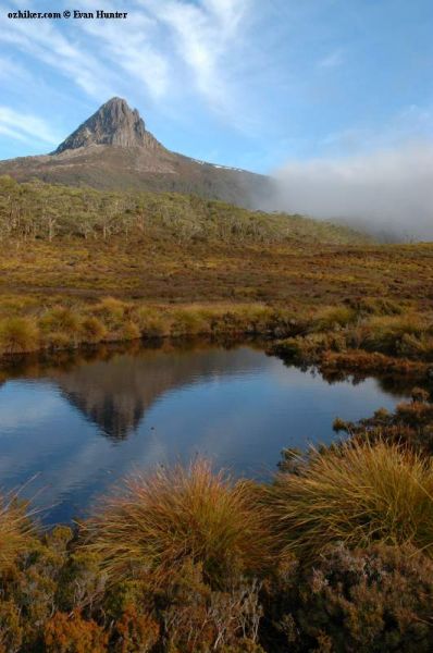
Meanwhile, Kate and Tim suggested we hike The Overland Track, in Tasmania, in January of 2009. The Overland Track is a six-day, 65km trek through Tasmanian Wilderness World Heritage Area from Cradle Mountain to Lake St Clair.

We've done a little preparation for this carry-all-your-stuff and camp out trek, but we need to do a lot more yet. That "don't worry - it's 2 years away" complacency has set in! So I have decided to include some of this hikes here, some I've done with Kate and Tim, and some I have done with bush walking clubs.

Now, for a few inspirational photos of The Overland Track:


Sunday, June 17, 2007

Just a 15km Hike

Just a 15km hike, pretty flat, not very interesting, a few tracks. Well, that's what we were led to believe. Perhaps George Adams was trying out some reverse psychology. Yes, it was pretty flat, yes, it was only 15km, yes, it was predominately tracks, but no, it wasn't boring.

The Lavender Federation Trail
Day 1: Murray Bridge to Monarto


The hike started after some car shuffling, starting at the Murray River. Even though it was about 9.15am, there was still a morning mist over the river, but it lifted quickly. I think it had been -1C here in Murray Bridge last night. After posing for some photos beneath the sign marking the official start point on the Lavender Federation Trail, we headed off along the old wharf area. Lots of history about: old railway locos and carriages, old riverboats - both floating and sunken - old bridges, old machinery and old buildings.


After leaving the wharf area we walked through the wetlands, and through some streets on the outskirts of the town out into the open farming land. We followed the Adelaide to Melbourne railway, stopping for a morning snack.


Next up was Rocky Gully - a real highlight of the day's hike. George led us the rock which features on the front cover of the official map, so we sent some people up to recreate the photo. We meandered through the gully, the creek and railway also meandered through. As we passed out of the gully, we ate lunch.

We walked past the Monarto Zoological Park, seeing some giraffes in the distance, perhaps also some bison (Bev saw some) and something else I can't remember.

George laid on some coffee and biscuits, as two cars were sent back to Murray Bridge to get the cars. Just in time too, not so soon after we all got into the cars but it started raining. Thanks for George organising today's hike, and organising the car pooling and lollies enroute - not to mention his contribution through South Australian Recreational Trails. A good hike.

Did today's hike through Friends of the Heysen Trail, and will do the next hike on August 19 (2007) and a third one this year on October 21 (2007).
  • Distance: 15.5km
  • Hike time: 4 hours

Saturday, June 16, 2007

The Lavender Federation Trail

The Trail
The 105km Lavender Federation Trail traverses the eastern flanks of the Mt Lofty Ranges, from the banks of the Murray River at Murray Bridge to the wine growing area of the Barossa at Springton in South Australia.

When complete, the trail is envisaged to continue over the Mt Lofty Ranges via the Barossa Range, past Angaston, Truro and Kapunda, to Clare, a journey of some 550km.


Trail Description
Beginning at Sturt Reserve, Murray Bridge on the banks of the Murray River, the Trail meanders past historic buildings, old riverboats undergoing restoration, past important wetland systems through to Rocky Gully Reserve on the outskirts of Murray Bridge.

This spectacular gully boasts steep rugged gorges with rocky outcrops and an abundance of native flora and fauna. At the northern side of Rocky Gully a loop trail provides rewarding views into the gully and a panorama across Murray Bridge. Allow at least three hours for this loop walk. Keep following the main trail and you may glimpse exotic animals as you pass the Monarto Zoological Park, an open range Bio Park.

Continue over grazing land and through forests to the eastern rim of the Bremner Valley. Then travel past abandoned stone farm houses, copper mines, along timeless creeks, over rock outcrops and ridges with views over the countryside.

The Trail makes its way to the summit of Mt Beevor, the most spectacular view of them all. To the north, the bush clad summit of Wirra Wirra peaks and the Barossa Range break the skyline, with glimpses of the Murray River to the east. On the edge of vision in the south, Lake Alexandrina stands out against the sand hills of the Coorong and the Southern Ocean while to the west, Mt Barker, Mt Lofty, Harrogate and the Bremner Valley complete the scene.

From Mt Beevor summit it’s a short walk via a spur trail to Diggers Rest north of Harrogate or continue to Tungkillo situated on the Adelaide to Mannum Road through quiet back roads, across creeks with an occasional glimpse of kangaroos. A loop trail north of Tungkillo allows a pleasant day walk or continue on the main track past spectacular rocky outcrops, open grazing country with views back to Mt Beevor and across the Murray Mallee. Gradually, glimpses of grapevines come into view as the trail reaches its current destination at Springton.

History of the Trail
The concept of the Trail came into being after a small group of walkers began to look for interesting walks in the hills to the west of Murray Bridge and found to their surprise a wealth of good walking country with high ridges, dramatic gorges, stately peaks and sweeping panoramas never before explored by walkers.

Since that time the idea of developing a trail between Murray Bridge and Clare has grown. Building of the Trail has been made possible with the financial and 'in-kind' assistance of State and Local Government authorities and local businesses and individuals. All track and administrative work has been performed by volunteers of South Australian Recreational Trails.

The Lavender Federation Trail is named in honour of the late Terry Lavender OAM, the architect of the trail and the first chairman of South Australian Recreation Trails.

Links