Friday, December 28, 2007

Old Beechy Rail Trail

A rail trail follows a former railway, so the track is always reasonably flat or has slight inclines or declines. And there's the trap for newcomers, ride the slight decline for 28km - barely even noticing the decline, then turn around and ride back - uphill all the way.

Old Beechy Rail Trail, the Otways, Victoria
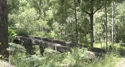


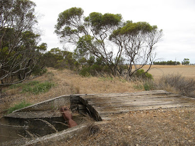
Remants of an old timber bridge

I spent two days whilst travelling along the Great Ocean Road in the cool shady forest. It was high 30's out there in the sun, but very cool riding in the forest. On the first day, I left my car in Colac and rode from the start of the rail trail, at the railway station, to Gelibrand, which is approximately half way along the track. It is uphill riding to Barongarook, which to be honest was quite tough. All of this section is along roads and not along the original railway alignment (the former railway did start in Colac, and the rail trail follows roads adjacent to the former railway). It was a very hot day to be out in the sun riding uphill on dirt roads, but after lots of rests and puffs of my ventolin, I made it to the start of the former railway just beyond Barongarook. Here the riding became very easy, being a steady decline to Gelibrand, with just a few off-the-former-railway-alignment sections. If I rode this trail again, I would start beyond Barongarook, the railway alignment starts at the 103 mile railway marker on Maggios Road. Part of the rail trail, just before Barongarook is on a bitumen road for several kilometres, could be a bit scary for the kiddies.
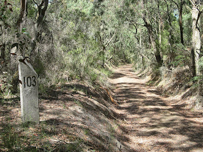

103 mile marker

Gelibrand was a welcome sight, enjoyed a nice lunch on the verandah of the general store. The ride home was quite a bit more difficult, mainly because it is uphill, and I didn't realise just how easy I had it riding downhill from Barongarook to Gelibrand. It's just that the incline is unrelenting, but you can see in the stats below that although it took me the same time to ride, I didn't need to rest for as long. I put that down to the uphill section being in the shady forest rather than the open sun, and being high on ventolin. The ridge from Barongarook downhill to Colac was easy.

The following day, having learnt something from the previous day, I left my car in Gelibrand. Gelibrand lies at the bottom of the valley, with the Colac at one end of the rail trail, and Beech Forest at the other end, both being at the tops of the ranges either side of Gelibrand.
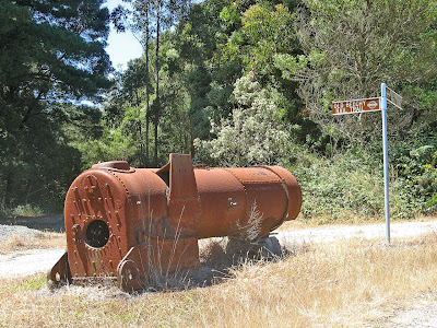

Old steam locomotive boiler at Dinmont

So I rode uphill towards to Beech Forest. I enjoyed this day much more than the first day, it was easier, and I was mentally prepared for it this time. The forest seemed much nicer, lots more bends, and much more riding along the former railway alignment rather than dirt roads. I stopped at Dinmont though, rather than the end of the rail trail at Beech Forest. From Dinmont to Beech Forest is entirely on dirt roads, so I didn't really see the point. No shops at Dinmont either, just a pub. I think future plans for the trail include the rail trail following the former railway from Dinmont to Beech Forest, and perhaps an extension to Lavers Hill and Crowes where the former railway terminated.

The ride back from Dinmont to Gelibrand was a lot quicker than the ride there. I did however fall for one trap... riding uphill from Gelibrand I came across a fallen tree which blocked the path. Trees in forests can be a bit difficult to move, I looked at trying to move it, but a chainsaw would really be needed. So anyway, you'd think I would remember it was there when I was riding back along that way later - because this time I would be riding much faster, being a long downhill run. I've got to say, in the dappled light of a forest, it is very difficult to see a single fallen log across the path when you are riding fast. I had to jump off my fast moving bike to save myself, and somehow I managed to get off and not take a tumble, although my bike got some damage from hitting the log and ground at such speed. It all happened slow enough though, as accidents do, for me to recall the log and realise how stupid I was. So I tried to mark the log a bit, to draw attention to it, but really, is there anyone else out there as stupid as me?
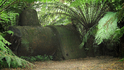

Old steam locomotive boiler near Triplet Falls

When I finished the ride, I enjoyed lunch again at the Gelibrand general store, and spent the afternoon wandering around some local sights - via car this time - like the town of Beech Forest and Triplet Falls. At Triplet Falls there was an old steam locomotive boiler hidden in the forest, amazing to think that all this area was completely cleared by the over-zealous settlers thanks to the railway, and that now you would have no idea that the land had been completely cleared at the start of last century.

I visited the Otway Fly, meh, it wasn't so great. $20 to get in, so not worth it. Although on the way out a couple of backpackers approached me for some tips as to how to avoid the entrance fee, ie in which direction to head to climb the fence. So I guess if they were successful it wasn't quite so expensive on a per-person basis.

Visit official Old Beechy Rail Trail webpage and download map and brochure.


View photos as full screen slideshow


Stats:
27 December
Colac-Gelibrand
  • Distance: 26.4km
  • Moving duration: 1h 43m
  • Stationary duration: 1h 14m
  • Moving average: 15.2km/h
  • Overall average: 8.9km/h
  • Max speed: 49km/h

Gelibrand-Colac
  • Distance: 26.4km
  • Moving duration: 1h 45m
  • Stationary duration: 39m
  • Moving average: 15.1km/h
  • Overall average: 10.9km/h
  • Max speed: 56.2km/h
28 December
Gelibrand-Dinmont
  • Distance: 14.1km
  • Moving duration: 1h 13m
  • Stationary duration: 45m
  • Moving average: 11.4km/h
  • Overall average: 7.1km/h
  • Max speed: 35.4km/h

Dinmont-Gelibrand
  • Distance: 15.2km
  • Moving duration: 44h 59m
  • Stationary duration: 6m
  • Moving average: 20.3km/h
  • Overall average: 17.7km/h
  • Max speed: 36.3km/h

Monday, December 24, 2007

It's Worth That 5 Minutes of Planning

Take the time to measure your planned hike on the map. No really, it's worth that 5 minutes of planning. And always have a spanner to remove your car tyre, a spare tyre is no use without the spanner.

3 hikes in Deep Creek Conservation Park


Blowhole Beach

Yes, really, just measuring how many finger-widths a hike is on a map just doesn't cut it. So really, should I have been surprised a hike was twice the distance I thought it would be? I mean really, could I be that stupid. Mmm... let's ponder a moment. Apparently the answer is yes.

Also, one needs a serviceable spare tyre, I had that, just no the spanner to remove the wheel with. Mmm. Damn it, obviously the first flat tyre since I got this car. So I had to walk 10km to get help, an unplanned hike. Thank goodness for daylight saving hey.


Tapanappa Hill

I camped at Trigg Campground for 3 days before Christmas, and did 3 hikes. The first was Deep Creek Circuit Hike, and despite the miserable weather I set out in, it soon cleared up to be a nice day. A really nice hike, this circuit is, going via Deep Creek Cove, Tapanappa Hill and Deep Creek Waterfall.


The second day I measure the day's hike with my finger on a map. We don't need to go there again. I hiked west along the Heysen Trail, past Eagle Waterhole campsite to Aaron Creek, then followed the creek to the coast. The creek trail was very overgrown, and the closer I got the coast the scratchier it became. I never quite made it to the end, but the coast was spectacular. I walked a different way home, via the flatter roads north of the Heysen Trail, longer, but quicker (although not as interesting either).

On the third day I did a short loop walk down to Blowhole Beach from Cobbler Hill Campsite. Beautiful, I love the beach and the rugged coastline immediately below Cobbler Hill. Lucky I did a short hike though, really, because driving back to the campsite I got a flat tyre. Pity I had no spanner. Mmm. So I had to walk 10km to get help, there was absolutely no-one around this day, perhaps cos it was Christmas Eve.


View photos as full screen slideshow


Stats:
Deep Creek Circuit Hike
  • Distance: 11.8km
  • Moving duration: 2h 51m
  • Stationary duration: 1h 17m
  • Moving average: 4.1km/h
  • Overall average: 2.8km/h
Aaron Creek Hike
  • Distance: 8.53km 1st leg (9.98 return leg)
  • Moving duration: 2h 01m 1st leg (1h 49m return leg)
  • Stationary duration: 1h 15m 1st leg (18m return leg)
  • Moving average: 4.2km/h 1st leg (5.5km/h return leg)
  • Overall average: 2.6km/h 1st leg (4.7km/h return leg)
Blowhole Beach - Cobbler Hill - Marrano Creek Hike
  • Distance: 6.43km
  • Moving duration: 1h 34m
  • Stationary duration: 1h 09m
  • Moving average: 4.1km/h
  • Overall average: 2.4km/h

Sunday, December 16, 2007

Encounter Bikeway

I got a nice sun tan today. I set off early, but then lost track of time. Yep, that sunnies mark on the side of my face. And one better, nice arms - but what's with the white hands? Riding gloves. Not a good look.


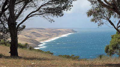
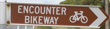
Hugging the coast from Goolwa to Victor Harbor, the 31km Encounter Bikeway follows bike paths, back roads and foot paths. A brochure is available from the Victor Harbor website.

I had ridden the bikeway before, but only from the bridge at Goolwa to the causeway at Victor Harbor. Today I rode the whole trail, some 7-8km longer, and then I rode back as well - last time I only rode one way. I rode 63km.

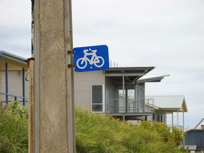
The trail is well sign-posted, except for in Port Elliot. I got lost going both ways, even with a map, there are a few signs missing at critical junctions in the town. The bike paths are the best bits to ride on, I think, and on the roads along the coast. Some of the roads inland are just houses and more houses, both old and crusty and contemporary new homes.


Riding back was quicker, because I didn't stop much except for 10 minutes to each some lunch, and I had a tail wind. Also, no photos on the way back.


View photos as full screen slideshow


Stats:
Goolwa to Victor Return ride
Distance: 32.2km Distance: 31.2km
Start time: 8:50am Start time: 11:25am
End time: 11:25am End time: 1:20pm
Moving duration: 2h 05m Moving duration: 1h 35m
Stationary duration: 30m Stationary duration: 20m
Moving average: 15.4km/h Moving average: 19.6km/h
Overall average: 12.7km/h Overall average: 16.2km/h
Max speed: 35.7km/h Max speed: 41.6km/h

Saturday, December 15, 2007

Nurragi Rail Trail

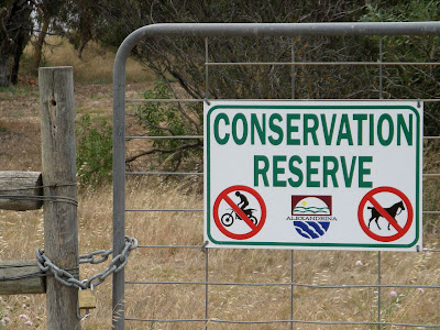
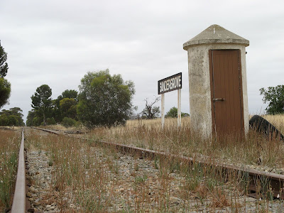
It was easy: 12km along the former railway from Sandergrove to Milang, beside Lake Alexandrina. A conservation reserve: no motorbikes, no horses, no dogs, oh, and no cyclists.


Well, not entirely true. There was no sign forbidding cyclists, but there were signs for the others, or it is just always the case in conservation areas. Cyclists were ok, I guess, however bear in mind that at every road crossing there are two fences to cross. There is a vehicle access gate - locked, so you have to carry your bike over the stile or throw your bike over the fence. I knew this though, I read about this rail trail on the Rail Trails website beforehand.

The railway was opened in 1884 as a branch line, and closed in 1970. The former railway was declared a conservation reserve in 1991, more information about the reserve can be found on the National Trust website.


I parked near Sandergrove railway station, then headed back to the station - not that there is much more than a sign to see adjacent the Steamranger tourist railway from Mt Barker to Goolwa and Victor Harbor. From here, I traced the former railway to Tucker Road, where the Nurragi Conservation Reserve began.


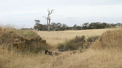
From Tucker Road to Dry Plains Road the trail is tough. It is not well clearly defined - although the former railway is, the walking path is not. It is overgrown in this area, and I started to have second thoughts about my plans, but this is the most overgrown section, and a relatively short section too. Be careful of a former bridge, marked on the google map below (as in be careful of the bridge that isn't there - could give you some nasty scars).


The stonework dates from the 1880's

From Dry Plains Road to the Finnis - Milang Road the path is much easier to ride or walk as it is a vehicle maintenance track. The only other bridge on the former railway, albeit smaller, has been remedied to allow vehicles to cross it.


There is plenty of birdlife to be seen, and kangaroos, and I'm sure snakes too.

It's a surprise to come across the former Nurragi Railway Station - from where the conservation reserve takes its name.


From an unnamed track crossing the trail, about half way between Nurragi Railway Station and the bitumen Finnis - Milang Road, to that bitumen road, the trail is quite overgrown. Returning on my ride from Milang, I chose to ride along the vehicle track which follows south-western fence.

From the bitumen road to the end of the conservation reserve the trail is a single width foot track. It is here, and back at Sandergrove Railway Station, where it is clear that motor bikes have been using the conservation reserve. Here too you can see evidence of horses and dogs (well, friendly people walking past with dogs).

The trail and conservation reserve ends at Landseer Road, on the outskirts of Milang. I think it would be quite possible to continue walking or riding along the former railway reserve straight into Milang - the land is still clearly fenced and looks to be used only for horse something or other. Whatever horses do. Eat grass I guess. The fact that the fencing remains on both sides would suggest it is still crown land and not private farmland. However, I was glad to ride faster and easier on a real road now.

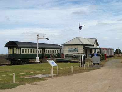
I rode onwards to Milang Railway Station. It's a cute timber building with some rollingstock beside it. The building was sold to a local farmer when the railway was closed, but was returned and restored in the 90s.


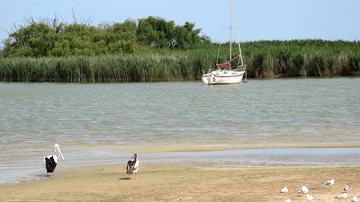
From here I rode the short distance down to the lakeside. Despite the drought, the lake still seems relatively high, although it is presumably at a level below sea level.


Riding back to my car was easier, I took some shortcuts which were longer but easier to ride. I also didn't suffer from the must-stop-and-take-a-photo-syndrome on the return journey. A good ride, very flat too.

This ride has nothing to do with the Mawson Trail, I know that. But I haven't been able to ride any of the Mawson Trail this year. Winter for me is hiking, and summer cycling, so I will post my future cycling adventures here. I stayed overnight in Goolwa after this ride, riding the Encounter Bikeway from Goolwa to Victor Harbor the following day. I will post up some photos and stuff for that one later this week.


View photos as full screen slideshow


Stats:
  • Distance: 29.6km
  • Start time: 1.35pm
  • End time: 4.50pm
  • Moving duration: 2h 22m
  • Stationary duration: 45m
  • Moving average: 12.4km/h
  • Overall average: 9.4km/h
  • Max speed: 29.3km/h

Wednesday, November 28, 2007

Keeping my Trailblazer Fitness

Just a couple of quick evening loop hikes around Morialta to keep my Trailblazer fitness

Morialta Conservation Park


Second Falls Gorge Hike
Time 2.5 hr return
Distance 5.3 km loop

Trail Notes
This trail skirts the rim of the escarpment and offers outstanding views of the gorge from First Falls and Second Falls lookouts. Stretch your legs and ascend the steep slope to Deep View Lookout for a view of the city. The first 700 m is a heart starter! If you prefer an easier gradient, hike in an anti-clockwise direction.


Download brochure (website)


Stats:
  • Distance: 6.8km
  • Moving duration: 1h 12m
  • Stationary duration: 18m
  • Moving average: 5.6km/h
  • Overall average: 4.5km/h

Saturday, October 20, 2007

Trailblazer

I can't understand why we struggled through the last sections from Morialta, other teams did too. Oh yeah, we'd been hiking for the past 11 hours.

The Trailblazer Challenge
50km: Adelaide Oval to Mt Lofty summit


So I wouldn't say it was easy, but it certainly wasn't as difficult as I thought it would be. I got no blisters, and only a very minor but manageable - thanks to Jenny's fantastic Black Diamond trekking pole - knee injury.

Likewise, other team members did well. One of our members deserves the 'best on ground' award for continuing on the course after throwing up bile after Morialta. Determined to finish, they kept up their fluids, and with some good rests along the way we all managed to complete the event together at Mt Lofty summit.

We met at the start point at Pinky Flat, near Adelaide Oval/Next Gen on the banks of the River Torrens. As Tim and I waited for the girls arrive, we got to see all the serious joggers psyche up for their events (There were 4 options available: 18km, 34km, 50km or 100km). Think ridiculously short shorts, and tubs of Vaseline being shamelessly applied. Not a pretty sight.


Myself, Tim, Coleen and Jenny at the start point beside the River Torrens

The first 18km to Athelstone follows Linear Park along the River Torrens to the hills. It was a 3 hour walk, following the bitumen pathways, so it can be hard on the feet, but we were 'in the zone' so it was all good. The free Red Bull, fruit and water top-up was a welcome sight at Athelstone. John, Jenny's partner, soon turned up with an esky and made us some fresh rolls - yummo.

It was about 10.45am when we left, hiking up what I consider the hardest hill on the trail. Or what I did consider the hardest, little did I know, our training preparation had led us the wrong way through Morialta, so the Trailblazer challenge still had a surprise in store for us. Regardless, this hill out from Athelstone, Ambers Gully, is steep and hot in the full sun.

By 2pm, when we reached Morialta, officially the 34km mark, it was quite hot. Ok, 33 degrees might not normally be considered hot, but it certainly makes hiking up hills in the sun a lot tougher. There's good reason why the hiking season is considered to be from April to October and not over summer. We ate some lunch in the hot shade and saw plenty of 50km participants withdrawing, the heat or the hike proving too much for them. Leaving Morialta we soon came across the little surprise that was awaiting us. An incredibly steep hill that I have little or no recollection of ever seeing before. It was also here where things took a turn for the worse for one team member.

Deciding to stick true to the course, we set up the next ridiculous hill, a recent re-route due to flood damage along the creek between the second and third falls. We saw plenty of participants head off along the closed, but considerably easier, section.

Hiking out of Morialta, we came across a ute with some eskies in the back - a support crew waiting for their team. Oh, how could they? What I would have done for a nice cold drink! Thankfully, one of them offered us some ice - they must have seen our expressions I'm sure. I'm no ice eater normally, but this was just heaven munching on ice.

Hiking through Horsnell Gully was a relief, the hot sun was now behind trees and the cool tracks and pathways were a welcome relief. The koalas were up to their normal antics, I love this place. Hiking out of Horsnell Gully, our last major hill aside from the last 650m to Mt Lofty summit, we were treated to some spectacular colours from the setting sun, the orange light lighting the pine trees in a magical way.

John was a very welcome sight at Checkpoint 3, at a radar station on a dirt road near Summertown. Tim and I got stuck into our freshly made wraps and a nice cold Pepsi Max, I'm sure I've never eaten a better wrap before. In a moment of sadism, the event organisers had chosen to place the checkpoint tent at the top of the hill where the radar tower stood, rather than down beside the roadway. We checked in and asked about medical help for our worsening bile-throwing-up member. No help or advise was available, but whilst we sat and ate we asked everyone who walked by if they were a paramedic. A seemingly random question, but the volunteers had told us a paramedic was hiking in a team of 3, apparently coming along soon. When he came, he admitted he didn't really care, he was too exhausted, but if one didn't actually feel too sick, they could continue, it was only the body saying it wasn't coping with the heat. It was only 5-7km left to the end, and it was dark now, so with no persuasion our sick member decided to continue.

Head torches on, we hiked through the cool of the forests of Cleland, along the winding fire tracks that follow the contours of the hill. Easy hiking, and with a bright moon overhead much more pleasurable with the head torch turned off.

Just after 9pm we stumbled out of the bush onto the paved area that the white obelisk and cafe sit on at the summit of Mt Lofty.


Saturday, October 13, 2007

Trailblazer Training

33.3km. The most I have ever hiked in a single day. Not bad, in preparation for next weekend's 50km Trailblazer hike.

Ambers Gully, Athelstone, to Mt Lofty Summit


Just one week until the big event, the 50km Trailblazer hike (a fundraising challenge). We haven't done a lot of specific training for it, so Tim and I thought we would make this one last opportunity. I've been doing lots of regular hiking, and been swimming twice a week, but today we set out to do the entire 33.3km section in the hills. Next weekend, we do the same, but start 18km earlier at from Adelaide Oval, following Linear Park to Athelstone, before doing what we hiked today.

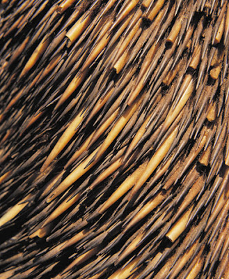
Pretty stoked that we saw an echidna in the Montacute Conservation Park, it was wandering along until it saw us and did the whole camo thing.


No, I didn't take this detail-photo of an echidna. No photos today.

It was tough, but we set a mean pace from the start. We had set out at 12 noon, we knew it was likely we would finish in the dark, but Tim had a prior engagement. I think I can safely say I have never hiked this fast before, after 4 hours of hiking we had only spent 21 minutes of that time resting. After 40 minutes for lunch at Norton Summit, yes it was 4pm by then, we had completed 19 of the anticipated 32km. Neither of us really felt any sorer after this point, although my knee started giving me grief in the last 5km (the next day though... woah, pretty sore hey).

We stayed true to the Trailblazer course, although because I had forgotten to bring the maps we strayed a little in Morialta. At Deep View Lookout we should have gone down to the carpark, then along the valley floor, whilst instead we maintained the same altitude and skirted around the edge. We didn't avoid the killer hill neither of us expected though, presumably a necessary re-route to avoid the bridge-less closed section of the Yurrebilla Trail.

Only during the last few kilometres did we put our head torches on, and the floodlit obelisk at the summit of Mt Lofty kept us going to the end. A nice look at the view was brought to a premature end as we started getting pretty cold. Wedges with a nice serving of sour cream and sweet chilli sauce worked a treat though in the cafe while we waited for Kate to come collect us.


Stats:
  • Distance: 33.3km
  • Start time: 12noon
  • End time: 7.20pm
  • Moving duration: 6h 10m
  • Stationary duration: 1h 09m
  • Moving average: 5.5km/h
  • Overall average: 4.5km/h