Sunday, February 24, 2008

Kick-Start the Training Again

Today we started our first training for this year, and where else close to Adelaide but the Waterfall Gully hike to Mt Lofty Summit?


We're excited about our plans to hike the Overland Track, amongst other overnight hikes in Tasmania, in December. So today for some training we hiked from the carpark at Waterfall Gully to the cafe on Mt Lofty summit, where we discussed the other hikes we wanted to do whilst we'll be in Tasmania. We'll be there for 3 weeks across Christmas, so we have decided to start off with a 2 day Walls of Jerusalem hike, followed by 6-7 days on the Overland Track, perhaps 2 days on the nearby Frenchmnas Cap walk, then travel to Hobart for some coastal walks - 2 days on the Cape Pillar track and finishing off with 2 days on the Freycinet Peninsula Circuit.

A popular training hike, Waterfall Gully to Mt Lofty Summit it short but tough. As you can see from the stats below, it's a lot quicker coming back down. We'll use these stats as a benchmark, as we plan to do regular hikes each fortnight on this trail and other challenging hills, perhaps in Morialta and Ambers Gully.

Tim and Kate also tested out their new hiking boots. Both passed, a little bit of lamb's wool around one toe and all good. I took one of my new trekking poles to try out (taking just one, does that make it a walking pole instead?), but didn't need it - I only need one when I injure a knee, which has been often in recent months, but not today. I use two trekking poles when hiking with a full 20kg-ish backpack so I was glad to purchase my new trekking poles which are very cool, lightweight, and a lot better than the two really cheap, heavy, ugly - and quite rattlie - ones I already had.

I have done some hiking over the past few months, however I have been lazy and not uploaded each to my blog. Here is a list of them, dating back from December to now, although the stories with them are a bit slap-dash given they are not quite so fresh in my mind now:
Stats:
Uphill: Waterfall Gully to Mt Lofty Summit
  • Distance: 3.88km
  • Moving duration: 55m
  • Stationary duration: 25m
  • Moving average: 4.2km/h
  • Overall average: 2.9km/h
Downhill: Mt Lofty Summit to Waterfally Gully
  • Distance: 3.88km
  • Moving duration: 43m
  • Stationary duration: 3m
  • Moving average: 5.3km/h
  • Overall average: 5.0km/h

Saturday, February 9, 2008

The Secret Foster Circuit

A circuit of Belair National Park - indeed the secret Foster circuit


Today Jerry and Michelle Foster invited some of us Heysen Trail End-to-End 2'ers to join them in their secret circuit of Belair National Park. Secret, you say. Well, maybe not, and certainly not anymore, but a 13km loop linking various hiking trails. It was a cool day in our very untypical February weather.

View the national park brochure


Stats:
  • Distance: 12.9km
  • Start time: 9.30am
  • End time: 1.30pm
  • Overall average: 3.2km/h

Sunday, January 20, 2008

Wet Socks

Meh, not such an interesting day, walking with wet socks through too much farmland on the Lavender Federation Trail

Pyms Rd to Tungkillo


A 4.45am alarm. Beep-beep--beep-beep. A nasty noise, I'm sure you'll agree. I hiked today, like last Sunday, with Graham and Steve. They're both nuts, this can't be disputed. I already knew this before agreeing to walk some of the Lavender Federation Trail with them. Last week, we met on the freeway at 6am. I was smart that time, I helped Tim and Kate with their kitchen on Saturday, and slept over at their house in Nairne, so I could get up at reasonable time. The early start was allegedly to avoid the heat of the day. However, neither day got hot, and it rained on both days (although was not cold).

So I planned to walk a third day with them too, which would finish the trail in Springton, the current end of the trail (the trail currently starts in Murray Bridge, and is planned to finish in Clare, a distance of some 550km). Anyway, yep, that third day, meeting at 5.30 am in the morning on a pretty average hike, nah, I'll skip that thanks. I'll do it with the Friends of the Heysen Trail when they walk this section on 3 August.


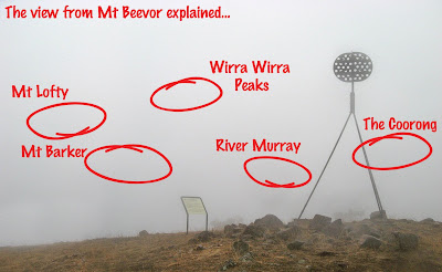
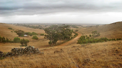
Yeah so today included some spectacular views from Mt Beevor, definitely the highlight of this section. Although... starting so early... there perhaps wasn't as much to see as the sign claimed. Beyond that to Tungkillo the trail was very much average, just farmland and fences. Although a quick tip for you, don't dress up in your favourite hay-bale costume, the cows will charge after you. Ok so I don't have a hay-bale costume, it's true, but that bright yellow backpack rain cover certainly attracted some unwanted interest - thankfully we were all armed with trekking poles. Otherwise I don't think I would be here to type this now... those cows were menancing.


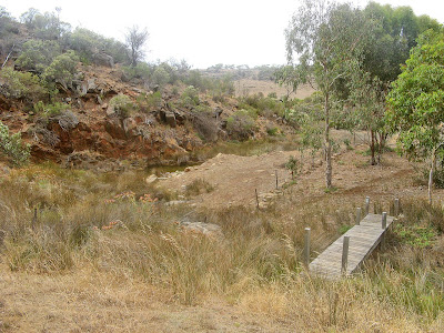
We had lunch near a creek, quite nice. A bit of a surprise. And we argued about how come we had already walked some 22km or so, and how come the walk was only meant to be 23km yet the car was still at least 7km away.


View photos as full screen slideshow


Stats:
  • Distance: 29km
  • Start time: 6.50am
  • End time: 1.22pm
  • Moving duration: 5h 31m
  • Stationary duration: 1h 01m
  • Moving average: 5.2km/h
  • Overall average: 4.4km/h

Sunday, January 13, 2008

Rainbow in a Sunrise

I've never seen a rainbow in a sunrise before. It was beautiful. Though I'm ashamed to admit it didn't occur to me it would rain.

Preamimma Mines to Pyms Road
Lavender Federation Trail


And rain it did. For the record though, the four of us walkers - Graham, Steve and Krystina - not one of us expected rain in early January. The weather forecast didn't include rain, so none of us had even the most basic rain protection. Thankfully, it wasn't very cold. And of course, by the time we finished and were driving back in the car, it was bright and sunny. As expected.


I think this is my favourite section of the Lavender Federation Trail. The first two sections I did, were ok, not great (Murray Bridge to Monarto, Monarto to Preamimma Mine).


Lots of water around too, which was a nice surprise. And lots of rocks too. Pity to see so much moss rock mining occuring, the pot-marked landscape wasn't so great to see.


View photos as full screen slideshow


Stats:
  • Distance: 23.5km
  • Start time: 7.20am
  • End time: 12:51pm
  • Moving duration: 4h 27m
  • Stationary duration: 1h 04m
  • Moving average: 5.3km/h
  • Overall average: 4.2km/h
  • Max speed: 11.9km/h

Friday, December 28, 2007

Old Beechy Rail Trail

A rail trail follows a former railway, so the track is always reasonably flat or has slight inclines or declines. And there's the trap for newcomers, ride the slight decline for 28km - barely even noticing the decline, then turn around and ride back - uphill all the way.

Old Beechy Rail Trail, the Otways, Victoria
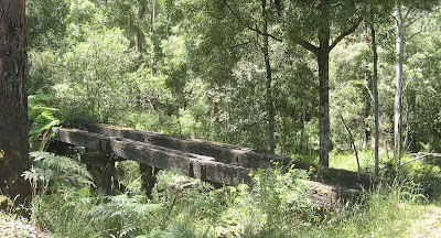


Remants of an old timber bridge

I spent two days whilst travelling along the Great Ocean Road in the cool shady forest. It was high 30's out there in the sun, but very cool riding in the forest. On the first day, I left my car in Colac and rode from the start of the rail trail, at the railway station, to Gelibrand, which is approximately half way along the track. It is uphill riding to Barongarook, which to be honest was quite tough. All of this section is along roads and not along the original railway alignment (the former railway did start in Colac, and the rail trail follows roads adjacent to the former railway). It was a very hot day to be out in the sun riding uphill on dirt roads, but after lots of rests and puffs of my ventolin, I made it to the start of the former railway just beyond Barongarook. Here the riding became very easy, being a steady decline to Gelibrand, with just a few off-the-former-railway-alignment sections. If I rode this trail again, I would start beyond Barongarook, the railway alignment starts at the 103 mile railway marker on Maggios Road. Part of the rail trail, just before Barongarook is on a bitumen road for several kilometres, could be a bit scary for the kiddies.
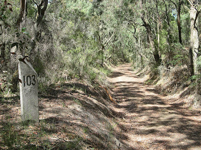

103 mile marker

Gelibrand was a welcome sight, enjoyed a nice lunch on the verandah of the general store. The ride home was quite a bit more difficult, mainly because it is uphill, and I didn't realise just how easy I had it riding downhill from Barongarook to Gelibrand. It's just that the incline is unrelenting, but you can see in the stats below that although it took me the same time to ride, I didn't need to rest for as long. I put that down to the uphill section being in the shady forest rather than the open sun, and being high on ventolin. The ridge from Barongarook downhill to Colac was easy.

The following day, having learnt something from the previous day, I left my car in Gelibrand. Gelibrand lies at the bottom of the valley, with the Colac at one end of the rail trail, and Beech Forest at the other end, both being at the tops of the ranges either side of Gelibrand.
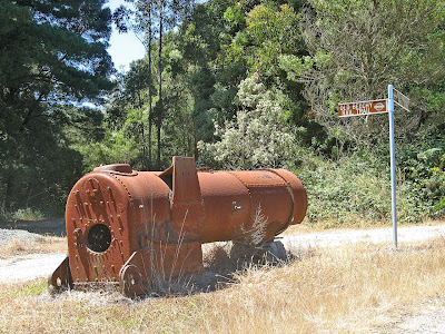

Old steam locomotive boiler at Dinmont

So I rode uphill towards to Beech Forest. I enjoyed this day much more than the first day, it was easier, and I was mentally prepared for it this time. The forest seemed much nicer, lots more bends, and much more riding along the former railway alignment rather than dirt roads. I stopped at Dinmont though, rather than the end of the rail trail at Beech Forest. From Dinmont to Beech Forest is entirely on dirt roads, so I didn't really see the point. No shops at Dinmont either, just a pub. I think future plans for the trail include the rail trail following the former railway from Dinmont to Beech Forest, and perhaps an extension to Lavers Hill and Crowes where the former railway terminated.

The ride back from Dinmont to Gelibrand was a lot quicker than the ride there. I did however fall for one trap... riding uphill from Gelibrand I came across a fallen tree which blocked the path. Trees in forests can be a bit difficult to move, I looked at trying to move it, but a chainsaw would really be needed. So anyway, you'd think I would remember it was there when I was riding back along that way later - because this time I would be riding much faster, being a long downhill run. I've got to say, in the dappled light of a forest, it is very difficult to see a single fallen log across the path when you are riding fast. I had to jump off my fast moving bike to save myself, and somehow I managed to get off and not take a tumble, although my bike got some damage from hitting the log and ground at such speed. It all happened slow enough though, as accidents do, for me to recall the log and realise how stupid I was. So I tried to mark the log a bit, to draw attention to it, but really, is there anyone else out there as stupid as me?

Old steam locomotive boiler near Triplet Falls

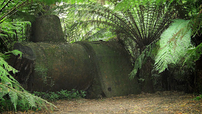
When I finished the ride, I enjoyed lunch again at the Gelibrand general store, and spent the afternoon wandering around some local sights - via car this time - like the town of Beech Forest and Triplet Falls. At Triplet Falls there was an old steam locomotive boiler hidden in the forest, amazing to think that all this area was completely cleared by the over-zealous settlers thanks to the railway, and that now you would have no idea that the land had been completely cleared at the start of last century.

I visited the Otway Fly, meh, it wasn't so great. $20 to get in, so not worth it. Although on the way out a couple of backpackers approached me for some tips as to how to avoid the entrance fee, ie in which direction to head to climb the fence. So I guess if they were successful it wasn't quite so expensive on a per-person basis.

Visit official Old Beechy Rail Trail webpage and download map and brochure.


View photos as full screen slideshow


Stats:
27 December
Colac-Gelibrand
  • Distance: 26.4km
  • Moving duration: 1h 43m
  • Stationary duration: 1h 14m
  • Moving average: 15.2km/h
  • Overall average: 8.9km/h
  • Max speed: 49km/h

Gelibrand-Colac
  • Distance: 26.4km
  • Moving duration: 1h 45m
  • Stationary duration: 39m
  • Moving average: 15.1km/h
  • Overall average: 10.9km/h
  • Max speed: 56.2km/h
28 December
Gelibrand-Dinmont
  • Distance: 14.1km
  • Moving duration: 1h 13m
  • Stationary duration: 45m
  • Moving average: 11.4km/h
  • Overall average: 7.1km/h
  • Max speed: 35.4km/h

Dinmont-Gelibrand
  • Distance: 15.2km
  • Moving duration: 44h 59m
  • Stationary duration: 6m
  • Moving average: 20.3km/h
  • Overall average: 17.7km/h
  • Max speed: 36.3km/h

Monday, December 24, 2007

It's Worth That 5 Minutes of Planning

Take the time to measure your planned hike on the map. No really, it's worth that 5 minutes of planning. And always have a spanner to remove your car tyre, a spare tyre is no use without the spanner.

3 hikes in Deep Creek Conservation Park


Blowhole Beach

Yes, really, just measuring how many finger-widths a hike is on a map just doesn't cut it. So really, should I have been surprised a hike was twice the distance I thought it would be? I mean really, could I be that stupid. Mmm... let's ponder a moment. Apparently the answer is yes.

Also, one needs a serviceable spare tyre, I had that, just no the spanner to remove the wheel with. Mmm. Damn it, obviously the first flat tyre since I got this car. So I had to walk 10km to get help, an unplanned hike. Thank goodness for daylight saving hey.


Tapanappa Hill

I camped at Trigg Campground for 3 days before Christmas, and did 3 hikes. The first was Deep Creek Circuit Hike, and despite the miserable weather I set out in, it soon cleared up to be a nice day. A really nice hike, this circuit is, going via Deep Creek Cove, Tapanappa Hill and Deep Creek Waterfall.


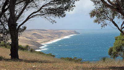
The second day I measure the day's hike with my finger on a map. We don't need to go there again. I hiked west along the Heysen Trail, past Eagle Waterhole campsite to Aaron Creek, then followed the creek to the coast. The creek trail was very overgrown, and the closer I got the coast the scratchier it became. I never quite made it to the end, but the coast was spectacular. I walked a different way home, via the flatter roads north of the Heysen Trail, longer, but quicker (although not as interesting either).

On the third day I did a short loop walk down to Blowhole Beach from Cobbler Hill Campsite. Beautiful, I love the beach and the rugged coastline immediately below Cobbler Hill. Lucky I did a short hike though, really, because driving back to the campsite I got a flat tyre. Pity I had no spanner. Mmm. So I had to walk 10km to get help, there was absolutely no-one around this day, perhaps cos it was Christmas Eve.


View photos as full screen slideshow


Stats:
Deep Creek Circuit Hike
  • Distance: 11.8km
  • Moving duration: 2h 51m
  • Stationary duration: 1h 17m
  • Moving average: 4.1km/h
  • Overall average: 2.8km/h
Aaron Creek Hike
  • Distance: 8.53km 1st leg (9.98 return leg)
  • Moving duration: 2h 01m 1st leg (1h 49m return leg)
  • Stationary duration: 1h 15m 1st leg (18m return leg)
  • Moving average: 4.2km/h 1st leg (5.5km/h return leg)
  • Overall average: 2.6km/h 1st leg (4.7km/h return leg)
Blowhole Beach - Cobbler Hill - Marrano Creek Hike
  • Distance: 6.43km
  • Moving duration: 1h 34m
  • Stationary duration: 1h 09m
  • Moving average: 4.1km/h
  • Overall average: 2.4km/h

Sunday, December 16, 2007

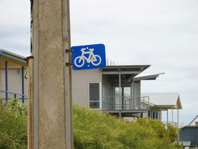
Encounter Bikeway

I got a nice sun tan today. I set off early, but then lost track of time. Yep, that sunnies mark on the side of my face. And one better, nice arms - but what's with the white hands? Riding gloves. Not a good look.


Hugging the coast from Goolwa to Victor Harbor, the 31km Encounter Bikeway follows bike paths, back roads and foot paths. A brochure is available from the Victor Harbor website.

I had ridden the bikeway before, but only from the bridge at Goolwa to the causeway at Victor Harbor. Today I rode the whole trail, some 7-8km longer, and then I rode back as well - last time I only rode one way. I rode 63km.

The trail is well sign-posted, except for in Port Elliot. I got lost going both ways, even with a map, there are a few signs missing at critical junctions in the town. The bike paths are the best bits to ride on, I think, and on the roads along the coast. Some of the roads inland are just houses and more houses, both old and crusty and contemporary new homes.


Riding back was quicker, because I didn't stop much except for 10 minutes to each some lunch, and I had a tail wind. Also, no photos on the way back.


View photos as full screen slideshow


Stats:
Goolwa to Victor Return ride
Distance: 32.2km Distance: 31.2km
Start time: 8:50am Start time: 11:25am
End time: 11:25am End time: 1:20pm
Moving duration: 2h 05m Moving duration: 1h 35m
Stationary duration: 30m Stationary duration: 20m
Moving average: 15.4km/h Moving average: 19.6km/h
Overall average: 12.7km/h Overall average: 16.2km/h
Max speed: 35.7km/h Max speed: 41.6km/h